The Sunapee, Ragged, and Kearsarge (SRK)
Greenway is a 75-mile loop of hiking trails in central New Hampshire. The
Greenway Trail System circles the Lake Sunapee area and
connects Sunapee, Ragged, and Kearsarge Mountains.
Our quest today is shown below: Section 7 topographical
map of the SRKG with a descriptive title of Trail 7 NH Route 4A to Wilmot
Center. This 4.4-mile section involves
two trails: the Bog Mountain Trail and Kimpton Brook Trail. This was our first
time on section 7, specifically Bog Mountain, for Patty, Jim and myself.

This Greenway map shows our
trip in green. The Greenway estimated time to hike is 3 hours. On our easterly ascent, we stopped frequently
for water breaks, and once for a snack, and took 20 to 30 minutes at the
summit. On our hike down to the western
trailhead terminus we stopped a few times for water, and then once for snack. Our total time for Section 7 was just under four hours.
This section of the SRKG is a
mixture of well developed wooded trails and woods-logging roads. Our goal was
to summit Bog Mountain, 1,787 feet, starting at the eastern trailhead parking
lot at the Wilmot Town Hall. We would be
doing all of section 7. For those hikers
wanting a shorter hike to the summit, we did cross two major dirt roads,
Stearns Road, and Pocket Road cross woods, that could be used to more readily
access the summit.

We picked up the bog mountain trail
within a minute of walking from the parking lot. This eastern side of the mountain was very
rocky, and reminded me of the saying, “Don’t take NH for Granite”. The trail up to the summit followed a vein of
granite appearing to be centuries ago, reminding me of previous hikes to the
White Mountains of NH with plenty of granite rocks.
For most of the eastern trail up to
the summit the trapezoid signs readily kept us on the trail. The views from the barren summit of Bog
Mountain was marvelous. We easily
recognized Mt Sunapee and Kearsarge Mountain and their surrounding mountains. Certainly,
well worth our trek.

The hike from the summit downward
to our western trail terminus was easier than the eastern side. However, the trail signs from the summit to
the western terminus were not always readily visible. It appears like the signage was made for
hikers entering on the western trailhead, as we frequently had to pause to locate
the trapezoid signs, and often spotted them only when we looked behind us from
whence we came.
We exited the Bog
Mountain Trail and crossed Stearns Road onto Kimpton Brook Trail. The Kimpton Brook Trail had large tree
blowdowns from winter storms that blocked the trail. Mixed into this, which made the Kimpton Brook
Trail hike exciting, was crossing at least 4 streams by leaping rock to rock,
using a blowdown tree, or a hewed log maybe 10 inches in diameter.

We now, never have to say, “I wish
I had hiked the SRG greenway section over Bog Mountain.”
Sunapee-Ragged-Kearsarge Greenway (SRKG) Trails Hiked by OutdoorSteve and Friends - Click below links
Sunapee Kearsarge Ragged Greenway
++++++++++++++++++- SRK Greenway Trail 1 Old Province Rd, Goshen to Newbury Harbor
- SRK Greenway Trail 2 Old Province Rd, Goshen to Sunapee Town Hall
- SRK Greenway Trail 3 Sunapee to Deerhill Springfield (Video featured on Bedford Community TV)
- SRK Greenway Trail 4 ProtectworthTrail, Springfield, NH
- SRK Greenway Trail 5 Springfield/New London to Great Brook Bridge
- SRK Greenway Trail 6 Great Brook Bridge to Wilmot 4A Wolf Trees and Trails
- SRK Greenway Trail 7 NH Route 4A to WilmotCenter
- SRK Greenway Trail 8 Wilmot Center to New Canada Road
- SRK Greenway Trail 9 New Canada Road to Proctor Academy
- SRK Greenway Trail 10 Proctor Academy to Winslow State Park Mt Kearsage
- SRK Greenway Trail 11 Rollins State Park via Lincoln Trail to Kearsarge Valley Road
- SRK Greenway Trail 12 – Kearsarge Valley Road to Wadleigh State Park
- SRK Greenway Trail 13 - Kezar Lake at Wadleigh Park to Chalk Pond
- SRK Greenway Trail 14 – Chalk Pond to Newbury
Sunapee Kearsarge Ragged Greenway
" Everyone must do something. I believe I will go outdoors with family and friends"
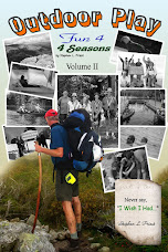
Steve's 5th book, Outdoor Play Fun 4 4 Seasons Volume II, is now available

http://outdoorsteve.com/Outdoor Play Volume II has trip preparations, routes, and narratives of bucket list places to go. The book motivates friends and family to make the outdoors a key component of their daily life.
Steve’s books are available as hardcopy and e-Books at Kindle and hardcopy at Morgan Hill Bookstore, New London, NH, Colby-Sawyer College, New London, NH, and Dartmouth-Hitchcock Gift Shop, Lebanon, NH.
Steve’s books are available as hardcopy and e-Books at Kindle and hardcopy at Morgan Hill Bookstore, New London, NH, Colby-Sawyer College, New London, NH, and Dartmouth-Hitchcock Gift Shop, Lebanon, NH.

No comments:
Post a Comment