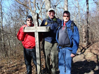
 Some folks believe the AT was an Indian trail. That assumption is not true. In 1922 Benton MacKaye, a forester from Massachusetts, had the vision of a continuous hiking trail from Georgia to Maine. A single AT was recognized in 1937 and is maintained by thirty-two non-profit organizations.
Less than twenty-five percent of through hikers - those who start from one end of the trail to the other - complete the entire trail. A thru-hiker can start at either of the trail's termini/starts - Mount Katahdin, Maine or Springer Mountain, Georgia.
The final mile of the AT passes through Forest Service Road (FSR) 42 near the top of Springer Mountain. From the small parking lot, you cross the FSR dirt road, and follow an AT wooden trail sign (with .9 miles engraved) and vertical white rectangular trail paint marks to its termination atop Springer Mountain. Visitors to the top of Springer Mountain can sign a logbook stored in a metal box encased in a rock holding one of the plaques.


Benton MacKaye Trail
As we returned to the parking lot, we encountered the Benton MacKaye Trail.
 This is a four and ½-mile spur off the AT that essentially brings you back to the Spring Mountain parking lot. In tribute to Benton MacKaye, we decided to take this trail to return to the parking lot.
Directions
It took many MapQuest searches, a few Google Earth reviews, and many Google Maps, before I found specific enough directions to Springer Mountain, the southern end of the AT. Click here see the Directions we took to reach the Springer Mountain parking lot from Kennesaw, GA. (note: There are other ways to get to the parking lot.) The Springer Mountain parking lot is located in the Chattahoochee National Forest nine-tenths (.9) miles from the top of Springer Mountain, where two rock-embedded plaques denote the southern end of the AT.
Ten point four miles of a Wildness Road
Our last ten plus miles to the Springer Mountain parking lot were on a one-lane rock infested and mud hole red dirt mountain road. Our bumpy ten mile per hour pace was jarring. We frequently had to pull off the road for on-coming cars. The road was literally cut into the side of the mountain with tall Georgia pines on each side.
 You surely need a four-wheel drive or SUV to use this route.
Resources for AT history, maps, planning and through-hiker experiences
A great resource to learn about the history of the AT, state by state trail maps, and how to plan the hike, can be located at www.appalachiantrail.org/
It takes the average AT hiker six months to finish the entire trail.
Never Say, “I wish I had…”

Shaun, Tim and I now, never have to say, “We wish we had been to the southern end of the AT.”
A Holiday Gift for the Outdoor Enthusiast
Give Outdoor Enthusiast: Never say, "I wish I had ..." as a special gift for the holidays. www.Amazon.com/


No comments:
Post a Comment