Friday, July 24, 2020

Three days hiking in Lincoln, New Hampshire.


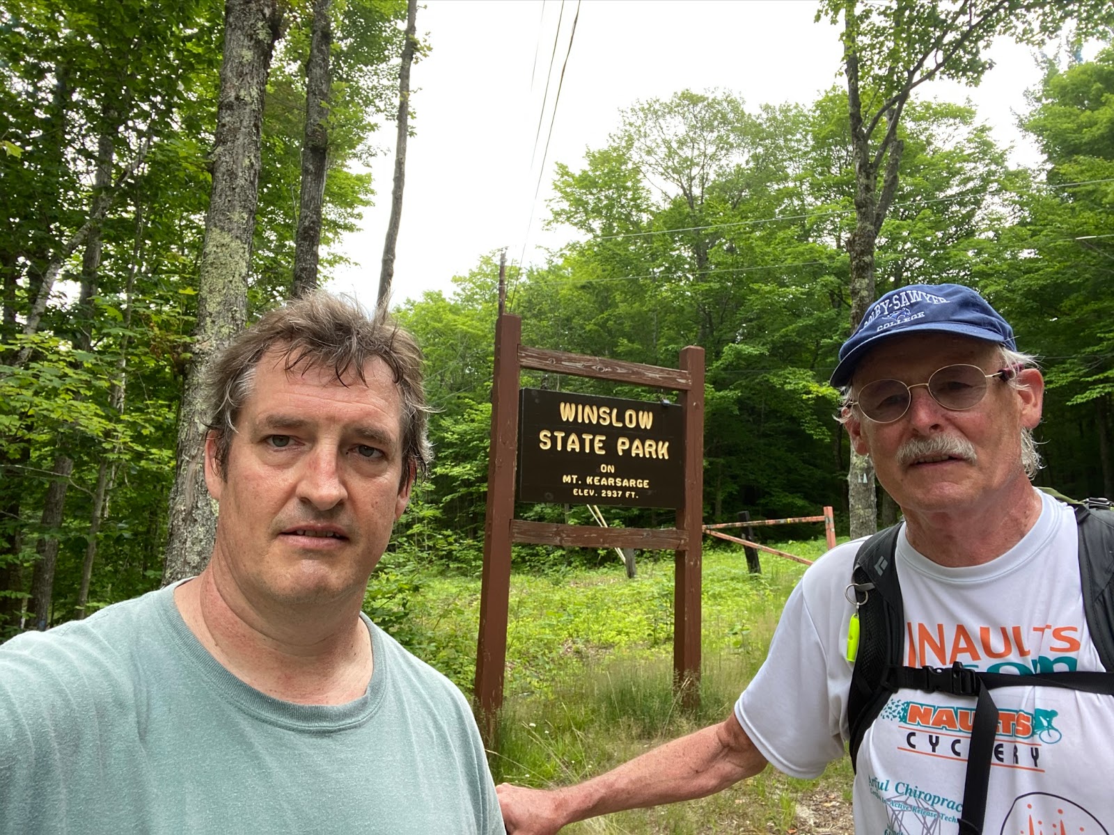
Long-time friends and hiking buddies, John, Lennie, and I, drove to LaFayette Campground in Franconia Notch to our registered campsite.
We arrived at 1 pm, set up our three tents, and headed for Georgiana Falls. Through a process of “Where do you want to go,” Lennie had selected Georgina Falls for the first of three hikes. One for each of the three days we stayed at the campground. 

Day 1: Hiking to Georgiana Falls in Franconia Notch, Lincoln, NH

According to 
Section Hiker referenced below, ”The Georgiana Path leads to two waterfalls in Franconia Notch, the lower and the upper Georgiana Falls on Harvard Brook. The 60 ft upper falls are a worthy destination and quite impressive after a rain. It’s located 1.3 miles up from the Georgiana Falls Path Trailhead off Rt 3, just outside of Lincoln, NH. The lower falls are also referred to as Harvard Falls.

You will need a certain amount of perseverance to reach the upper falls, however. The trail up is clear to the lower falls but harder to follow as you hike higher upstream. Look for sporadic red blazes and stay within sight of the brook, and you should be able to follow the many herd paths that lead up to the upper falls. The area is highly eroded and steep in places, but well worth the effort to climb, leading to a viewpoint directly across from the falls. Bushwhacking a bit higher, you can also climb to the point where the falls start their plummet over the drop."

Total Distance: 3.1 miles Round trip, w/ 750 feet of elevation gain. Level of Difficulty, as survived by Steve, was “extremely difficult.” I did not mean this rating in terms of hiking skill, but because of the effort climbing up, over and around boulders, over fallen logs, all the while doing this crawling up and the hillside. Plus it was up, up, and up.

Truthfully, if it were not for the encouragement (politely said) of John and Lennie, I would have readily turned around to return to the trailhead. The Section Hiker said it, “You will need a certain amount of perseverance to reach the upper falls.”


Day 2: Hiking Lincoln Woods Trail to Franconia Falls, Lincoln, NH

On the Kancamagus Highway, just outside of Lincoln, is the Lincoln Woods Trailhead, as announced by a large sign. A ranger station, parking area, and toilet facilities are available. Lennie, John, and I arrived early in the morning, and the parking lot was already beginning to fill up. As advertised, this is a very busy trail. 
We started our 7.1 round trip hike mile by crossing a long suspension bridge over the East Branch of the Pemigewasset River. The river flow and scenic views from the deck are delightful to enjoy. However, our goal, Franconia Falls, was three-plus miles away, so we kept on moving.

The Lincoln Woods Trail follows an old railroad trail, which includes remnants of railroad ties, and kiosks of information on the long-ago railroad and this wilderness area. Once over the bridge, you go left and follow the Lincoln Woods Trail, a straight line trail for 2.8 miles

The East Branch, as well as some tributaries, accompanied the trail for much of the route. A few spur paths lead closer to the river shore. At 2.8 miles, we came to what looked like the end of the trail but was a 4-foot-high rock cement wall. On the other side of the wall was another long bridge, this one crossing Franconia Brook to continue further into the White Mountains National Forest.

We admired the views from the bridge, then turned back to follow a sign on the left showing .4 miles to Franconia Falls.

This Franconia Falls Trail follows Franconia Brook upstream to Franconia Falls.

Reaching the Falls, we dropped our packs and hopped over huge boulders to the middle of the Falls with elegant views of the water dancing over the rocks and finding its way heading downstream.

John and Lennie cooled their feet in the flowing falls. I stripped to my bathing suit and took a waist-high dip in the falls.


Statistics of our hike: Lincoln Woods Information Center to Franconia Falls and return.
  • Lincoln Woods Information Center- Lincoln Wood Trail to Franconia Falls Trails Sign = 2.7miles
  • Franconia Falls Trails Sign to Franconia Falls on Franconia Falls Brook = .4 miles
  • Overall hike: distance 7.2 miles
  • Overall Time 3.5 hours.
  • Level of Difficulty: Easy. Beautiful family hike. BUT remember, this is a 7.2 miles hike. This distance may not be suitable for some in your group. Also, when in the Franconia Falls, this can be a perilous situation, so children, and others not paying attention, can be threatened by the Falls.

Day 3: Serendipity Loop Trail from Kancamagus Highway Lincoln, NH

This was our final day in the White Mountains. Our Georgiana Falls hike on Monday took a physical toll as we needed perseverance to reach the upper fall because of the effort climbing up, over and around boulders, over fallen logs, all the while doing this crawling up the hillside. Our Tuesday hike was not difficult, but did require a 7.1 mile hike. Wednesday’s hike was a one hour cool down with an easy hike before our two plus hours driving home.


Serendipity Loop Trail is a 2.3 mile moderately trafficked loop trail located near Lincoln, New Hampshire alongside the East Branch of the Pemigewosset River, and is suitable for all skill levels. The path is primarily used for hiking, walking, nature trips, and bird watching.

We saw some blowdowns in the East Branch of Pemigewasset River as we followed the river in our clockwise trail. We approached the water when we saw animal tracks we could not identify.

We had one decision to make when we reached the sign for our return trail. We were confused because the sign seemed to point us to continue along the river. However, Lennie’s Alltrail app map confirm we keep right on the return trail. During our discussions, Lennie and I compared my MapMyRun app with his Alltrails app. I put together comparing the different apps using the Serendipity Trail.

Enjoy this Serendipity Loop Trail video.


References
++++++++++++++++++
"Everyone must do something. I believe I will go outdoors with family and friends"

Steve’s books are available as hardcopy and e-Books at Kindle and hardcopy at Morgan Hill Bookstore, New London, NH, Colby-Sawyer College, New London, NH, and Dartmouth-Hitchcock Gift Shop, Lebanon, NH.

Outdoor Play has trip preparations, routes, and narratives of bucket list places to go. The book will motivate friends and family to make the outdoors a key component of their daily life. If you want 5 or more books signed, send Steve an email and we can work out the logistics.


Additional sources of Books:
Hardcopy at: http://outdoorsteve.com and https://www.amazon.com/dp/098503842X
E-book at: https://www.amazon.com/dp/098503842X

Thursday, July 23, 2020

A Sunday Morning Paddle on Hopkins Pond with Gus


From below Wikipedia reference, "Hopkins Pond (also known as Adder Pond, although no one seems to know where the name Adder came from) is a small pond located at the south foot of Ragged Mountain, in the town of Andover, New Hampshire. It lies at an elevation of 644 feet (196 m). The pond is part of Proctor Academy's 2,500-acre (10 km2) campus in Andover and is jointly managed by Proctor and the New Hampshire Fish and Game Department. The pond area is open to the public for non-motorized boat travel, fishing and hiking.

This shallow pond has an average depth of 6 feet (1.8 m), is 15 feet (4.6 m) deep at the deepest point, and covers a total area of 27 acres. It empties eastward into Mountain Brook below Elbow Pond. Mountain Brook, in turn, is a tributary of the Blackwater River, which flows via the Contoocook River and Merrimack River to the Gulf of Maine (Atlantic Ocean) at Newburyport, Massachusetts."


Enjoy the below video.


Carry a too long kayak inside your trunk? 
Warning! Be sure to tie your kayak to the vehicle!!
Reference
https://en.wikipedia.org/wiki/Hopkins_Pond_(New_Hampshire)

++++++++++++++++++

"Everyone must do something. I believe I will go outdoors with family and friends"

Steve’s books are available as hardcopy and e-Books at Kindle and hardcopy at Morgan Hill Bookstore, New London, NH, Colby-Sawyer College, New London, NH, and Dartmouth-Hitchcock Gift Shop, Lebanon, NH.

Outdoor Play has trip preparations, routes, and narratives of bucket list places to go. The book will motivate friends and family to make the outdoors a key component of their daily life. If you want 5 or more books signed, send Steve an email and we can work out the logistics.


Additional Sources of Books at:
Hardcopy at: http://outdoorsteve.com and https://www.amazon.com/dp/098503842X
E-book at: https://www.amazon.com/dp/098503842X

Tuesday, July 14, 2020

The Lincoln Trail 11 Extension to the Summit of Mt Kearsarge


Mt Kearsarge is the highest peak (2,937 ft.) of the Sunapee-Ragged-Kearsarge Greenway (SRKG.) I just came to the realization how much Mt Kearsarge lends itself to the SRKG, and how much of my hiking has revolved around Mt Kearsarge. Doing Trail 10 (Proctor Academy to Winslow State Park) and Trail 11 (Winslow State Park to Kearsarge Valley Road), combined with my previous hikes to the summit from Winslow Park (ascending and descending using the Barlow and Winslow Trails) and Rollins Park (ascending and descending using Rollins Trail), was not complete, because I had never used Lincoln Trail to the summit.

On top of this, being the highest mountain in our immediate area, Mt Kearsarge has been visible from many other SRKG trails (i.e., Mt Sunapee Trail 1, Newbury Harbor to Old Providence Road, Goshen, and Trail 13, Wadleigh Park, Sutton to Chalk Pond, Newbury.) Plus, Mt Kearsarge is seen prominently as I kayak in Kezar Lake, Sutton, and Bradley Lake, Andover.

As I looked at the map of the SRK Greenway 75-mile loop of hiking trails, and particular Trails 10 and 11, I realized I had never hiked one section of the Lincoln Trail, Rollins Park to the summit of Mt Kearsarge. Before my SRKG quest, I had never paid attention to the Lincoln Trail because the Lincoln Trail was known to step steeply down a talus field and be very dangerous in wet and icy conditions. However, if I were to be true to myself about hiking all of the SRKG trails, I needed to complete the Lincoln trail from Rollins Park to the Mt Kearsarge summit.

Sunapee-Ragged-Kearsarge Greenway Trail 11 Mt Kearsarge Lincoln Trail to Kearsarge Valley Road 
is the blog post that completes the Lincoln Trail from the Rollins parking area to Kearsarge Valley Road.


Finishing the Lincoln Trail - Rollins Park to Mt Kearsarge Summit

Indeed, the warning signs about this section of the Lincoln trail are not overemphasized. For much of this .4 mile section, it meant me climbing over a collection of huge broken rock fragments that have accumulated through periodic rockfall from Mt Kearsarge’s adjacent cliff faces.

I started with my walking poles, but as soon as I began climbing up and over intermixed boulders and pointed rock fragments, I had to stop and store my poles on my backpack. This section of the Lincoln Trail was no place to use poles.


I had estimated my .4 mile hike to be a half-hour. My actual time was one hour. Yes, I stopped to take in the magnificent views and to tie my poles to my pack, but indeed I must admit I used my hands, knees, and butt to achieve the section through the talus field.

The Video

Enjoy my hike up the Lincoln Trail from Rollins Park to the summit.


SRKG Completion Medal
I now, never have to say, "I wish I had hiked the SRKG Trail 11 from the summit of Mt Kearsarge to Kearsarge Valley Road, including the talus field of the Lincoln Trail."


Sunapee-Ragged-Kearsarge Greenway (SRKG) Trails Hiked by OutdoorSteve and Friends - Click below links
  1. SRK Greenway Trail 1 Old Province Rd, Goshen to Newbury Harbor
  2. SRK Greenway Trail 2 Old Province Rd, Goshen to Sunapee Town Hall
  3. SRK Greenway Trail 3 Sunapee to Deerhill Springfield (Video on Bedford Community TV)
  4. SRK Greenway Trail 4 ProtectworthTrail, Springfield, NH
  5. SRK Greenway Trail 5 Springfield/New London to Great Brook Bridge
  6. SRK Greenway Trail 6 Great Brook Bridge to Wilmot 4A Wolf Trees and Trails
  7. SRK Greenway Trail 7 NH Route 4A to WilmotCenter
  8. SRK Greenway Trail 8 Wilmot Center to New Canada Road
  9. SRKG Greenway Trail 9 New Canada Road to Proctor Academy via Ragged Mountain
  10. SRK Greenway Trail 10 Proctor Academy to Winslow State Park Mt Kearsage
  11. SRK Greenway Trail 11 Rollins State Park via Lincoln Trail to Kearsarge Valley Road
  12. SRK Greenway Trail 12 – Kearsarge Valley Road to Wadleigh State Park
  13. SRK Greenway Trail 13 - Kezar Lake at Wadleigh Park to Chalk Pond
  14. SRK Greenway Trail 14 – Chalk Pond to Newbury
    ++++++++++++++++++

    "Everyone must do something. I believe I will go outdoors with family and friends"

    Steve’s books are available as hardcopy and e-Books at Kindle and hardcopy at Morgan Hill Bookstore, New London, NH, Colby-Sawyer College, New London, NH, and Dartmouth-Hitchcock Gift Shop, Lebanon, NH.

    Outdoor Play has trip preparations, routes, and narratives of bucket list places to go. The book will motivate friends and family to make the outdoors a key component of their daily life. If you want 5 or more books signed, send Steve an email and we can work out the logistics.


    Additional Sources of Books at:
    Hardcopy at: http://outdoorsteve.com and https://www.amazon.com/dp/098503842X
    E-book at: https://www.amazon.com/dp/098503842X


    Thursday, July 9, 2020

    July 4th Swim Across Perkins Pond - God Bless America and those who serve and served our country for freedom


    A nearly one-mile July 4th swim for nine swimmers, accompanied by three boats with appropriate life preservers and throw cushions.

    Remember Why We Celebrate July 4th. God Bless American and Those Who Serve and Served Our Country.


    Monday, July 6, 2020

    Knife Edge Trail to Baxter Peak at Northern Terminus of Appalachian Trail

    Paul, my friend and one of the Knife Edge Trail participants, told me he had never seen the Bedford Community Television movie of his/our Knife Edge, Mt Katahdin, Maine hike. Here is the film for Paul and all the participants to enjoy and cringe, as they cross the one plus mile and 5,000-foot elevation Knife Edge Trail. Oh, and the trek took 15 hours. Whew!
    ---------------

    Six friends planned a long day of hiking, only to find a day and evening of climbing.  The plan seemed relatively simple:

    1. Hike to Baxter Peak, the northern terminus of the 2,162 mile Appalachian Trail (AT).
    2. Cross the fabled 1.1 mile Knife Edge Trail.
    3. Hike five miles on the AT starting at its northern beginning at Baxter Peak.

    Our ultimate achievement through endurance and teamwork brought more satisfaction because of the challenges and time on the mountain. Below are comments, maps, pictures, and videos of our climb. Our Mt. Katahdin accomplishment was both physically demanding, and mentally tough. I am extremely proud of my fellow adventurers and how we worked together for this team triumph.


    Mount Katahdin is the highest mountain in Maine at 5,269 feet. Named Katahdin by the Penobscot Indians, the term means "The Greatest Mountain". It is part of the Appalachian Mountain range and is located in Baxter State Park. Baxter State Park is a large wilderness area permanently preserved as a state park, located in Piscataquis County in north-central Maine. It covers 327 square miles.


    The Knife Edge was the highpoint of our trip, but the descent from Pamola Peak was nearly as challenging as we had to use technical rock climbing skills.

    Our trip started at Roaring Brook campground on the Chimney Pond Trail at 6:45 am. We arrived at Chimney Pond Campground after a 2 hr 45 minute hike. From the Campground we took Dudley Trail to Pamola Peak. We had to do a 40 foot rock straight down climbing descent grabbing cracks in the granite rocks while seeking spots for footholds. Then immediately followed up by climbing straight up 40 feet to Chimney Peak. FYI, counterintuitively up is easy because gravity isn’t pulling you down and you and can see where to put your feet. Admittedly this 80 feet was the most challenging section for this author. Once atop Chimney Peak we climbed and scooted the 1.1 mile Knife Edge Trail. This brought us to South Peak. Our 15 hour trip was an unrelenting 11 miles. We finished the last two hours with headlamps.

    Enjoy and cringe the below video of how we planned our Mount Katahdin hike - and what it looks like in crossing the Knife Edge Trail.


      Below is the time and miles breakdown by trail:


      Trails
      Start
      End
      Total Trip Hrs:Min

      Hours 


       Miles

      Comments
      Roaring Brook Campground to
      Chimney Pond Campground
      Start 6:45 am

      9:30 am
      2 ¾ hrs

      3.3 miles
      Chimney Pond Trail easy hike.  4 of us used Tracking Poles.  Some nice side trail views.
      Chimney Pond Campground to Pamola Peak via Dudley Trail
      10 am
      1 pm
      3 hrs

      1.4 miles
      After a snack and rest at Chimney Pond Campground, we tied our tracking poles to our packs.  The Dudley Trail is a 2,000 elevation gain and a relentless massive granite boulder laden trail nearly straight up requiring our hands for pulling, grabbing rocks and hand holds, our legs for pushing, our arms for lifting our bodies, our feet for pushing and toe holds, and our butts to sliding up and holding our bodies at times.
      All of us were exhausted.  Indeed it was a very trying physical test of our mettle.
      Pamola Peak to Chimney Peak/Knife Edge
      1:20 pm
      2:12 pm
      ¾ hr
      Our descent down the 40 foot drop from Pamola Peak was technical “rock climbing” .  We held indentations in the rocks while reaching for footholds.  Indeed for this descent we used using hands, arms, body and butt.
      Knife Edge to South Peak
      2:12
      3:00 pm
      1 hr

      .8 miles
      A 1.1 mile balancing act along the ridge of the Knife Edge Trail. Prior to this trip I had visions of panicking because of the elevation and 1000 foot drop offs and extremely narrow trail.  Truthfully, I had no fear as I crossed this very unique trail.
      South Peak to Baxter Peak
      3:00
      3:50 pm
      1 hr

      .3 miles
      This ridge trail went up and down.  Just when we got to the top of the trail, it would drop and we would start another descent.  Then an ascent followed by another descent.  We were close to 7 hours since we left Roaring Brook campground and were tired.  At each high ledge we could see Baxter Peak, but could not differentiate the rolling ridge.
      Baxter Peak  via Hunt Trail through Table Land
      4:00 pm
      5:15 pm
      1 ¼ hr

      1.0 miles
      Tableland was like a country hike.  It was flat and a welcome hike.  We passed the famous Henry David Thorough Spring. We had been hiking for near ten hours. 
      Hunt Trail after TableLand to Katahdin Stream Campground
      5:15 pm
      10:00 pm
      4.5 hrs

      4.2 miles
      We were now headed down and home, BUT still had 4.2 miles according to the trail sign. The first two miles were a steep down and over rough granite.  We did have some technical areas.  One section had steel handles in the granite to make the descent from huge ledges a bit easier.
      Took us two hours just to get below the tree line.
      At 8:30 pm we put on our headlamps.  We used our trekking poles to give us stability through the downward rock strewn path.

      At 10 pm we reached the ranger check-in station where we signed-on the register that six of us were back. We also met the Park Ranger who had been told by two people who passed us earlier in the dark with headlamps and that we were fine and on our way
      TOTAL HOURS
      6:45 am
      10:00 pm
      11 miles

       15 hrs!


      What a Journey!!!


      Knife Edge Trail
      We were into our hike for about 6 ½ hrs. of rock strewn, rugged and prolonged steepness, on the Dudley trail, reaching Pamola Peak, followed by a technical Pamola descent, we ascended Chimney Peak, the start of the almost mile high Knife Edge Trail. Whew!

      The Knife Edge Trail is perhaps the most spectacular trail in New England – and also the most dangerous. It would take us two hours to cross from Chimney Peak to Baxter Peak.

      We were advised to avoid the Knife Edge in stormy weather. The exposure to high winds and lightning is extreme. We were warned once we decide to cross the Knife Edge we MUST CONTINUE ON THE TRAIL. There is no safe way to descend off either side of the mountain ridge.

      The mile long path stretches across the South Basin’s headwall between Pamola and Baxter Peak. I believe you will get a sense of what these six outdoor enthusiasts experienced crossing this unique narrow mile-high ridge with 1,000 foot drops on both sides. At one point for about 20 feet the width of the ridge was close to 10 inches. The views, when we dared a birds-eyed glimpse, are magnificent and certainly breathtaking.

      Are You Ready for Katahdin?

      A very special thanks goes to Linwood and Betty of Loons Nest (http://www.loonsnest.biz/) for their immense help in preparing this trip.
      Click this link to SUBSCRIBE to OutdoorSteve's YouTube Channel
      References

      Sunday, July 5, 2020

      SRKG Trail 10, Proctor Academy in Andover, NH to Winslow State Park in Wilmot, NH


      Sunapee-Ragged-Kearsarge Greenway (SRKG) Trail 10, Proctor Academy in Andover, NH to Winslow State Park in Wilmot, NH, is rated by the SRK Greenway Guide as moderate. I will say this may be a bit underrated in that most of the six-mile hike is relatively uphill. The Guide lists the Total Ascents as 1300 feet, and the Total Descents as 140 feet. Add to this the fact the bugs were swarming around us for most of our 3-hour hike.

      This hike was indeed special to me because it was with my son, Timothy. Timothy has hiked four of the SRKG trails with me, and hiking together offers us an opportunity to share happenings in our life, and remembrance of our many outdoor adventures together. 


      SRK Greenway Guide Third Edition Changes

      As is my practice for each of the thirteen SRKG hikes I have completed, I locate the trailheads with my wife before taking a hike. This assures me I can show up at 6:30 am the day of the hike, and not have to search for the trailhead. With Trail 10, this proved to be good practice. We readily found the northern trailhead at Farrel Field Houe at Proctor Academy on Route 11 and US 4. However, as we walked the beginning of the trail, at .3 miles the Guide had us “crossing the Northern Rail Trail,” and “bending left toward the Proctor ski hill, the SRKG continues through the flood plain and crosses the Blackwater River on a low cable bridge.” The Guide had us going on the Northern Rail Trail in a direction opposite from the SRKG trapezoid directional signs. Oops. Cathy and I followed the SRKG trapezoids, and in reading the Guide, the book and the trapezoids finally come together at “At 1.1 mile the SRKG meets Bridge Road just south of a fine covered bridge.”

      We followed only the trapezoid signs until “... the SKRG continues straight into the woods …” from which the trapezoid and Guide were in synch. Afterward, I checked with Morgan-Hill Book Store to see if they had a more current addition than the 3rd Edition, and they did not. The srkg.org Guide Book picture also shows the Third Edition as the current reference. 

      As my readers know, the SRKG Guide has been my on-the-trail reference book for all my SRKG hikes. 

      I will report my observations to the SRKG Coalition.

      The Hike

      The SRKG Trail 10 leaves Proctor Academy in Wilmot on the northwest shoulder of Mount Kearsarge. It uses several unmaintained Class VI roads. The terrain is somewhat muddy and rocky at times, but generally easy walking. My MapMyRun shows Timothy and I averaging between 27 and 29 minutes per mile, depending on the steepness of the area were we in.
      Northern Rail Trail


      We were only on the Northern Rail Trail for less than a half SRK Greenway Guide mile, but we enjoyed the distance markers.

      People ask what does WRJ 40 mean? What does B 103 mean? These were from olden days, meaning, 40 miles from here to White River Junction (VT), and 103 miles to Boston (MA).


      Barlow Hike to the Top of Mt Kearsarge 

      I have hiked the Barlow Trail many times from the Winslow Park parking lot. Here is one of those treks where we went up the Barlow Trail, and returned on the Winslow Trail.

      Hiking Mt Kearsarge in Central New Hampshire https://outdooradventurers.blogspot.com/2014/06/hiking-mt-kearsarge-in-central-new.html


      SRKG Completion Medal


      We now, never have to say, "We wish we had hiked the SRKG Trail 10 from Proctor Academy to Winslow State Park Mt Kearsarge."

      Sunapee-Ragged-Kearsarge Greenway (SRKG) Trails Hiked by OutdoorSteve and Friends - Click below links
      1. SRK Greenway Trail 1 Old Province Rd, Goshen to Newbury Harbor
      2. SRK Greenway Trail 2 Old Province Rd, Goshen to Sunapee Town Hall
      3. SRK Greenway Trail 3 Sunapee to Deerhill Springfield (Video on Bedford Community TV)
      4. SRK Greenway Trail 4 ProtectworthTrail, Springfield, NH
      5. SRK Greenway Trail 5 Springfield/New London to Great Brook Bridge
      6. SRK Greenway Trail 6 Great Brook Bridge to Wilmot 4A Wolf Trees and Trails
      7. SRK Greenway Trail 7 NH Route 4A to WilmotCenter
      8. SRK Greenway Trail 8 Wilmot Center to New Canada Road
      9. SRK Greenway Trail 9 New Canada Road to Proctor Academy
      10. SRK Greenway Trail 10 Proctor Academy to Winslow State Park Mt Kearsage
      11. SRK Greenway Trail 11 Rollins State Park via Lincoln Trail to Kearsarge Valley Road
      12. SRK Greenway Trail 12 – Kearsarge Valley Road to Wadleigh State Park
      13. SRK Greenway Trail 13 - Kezar Lake at Wadleigh Park to Chalk Pond
      14. SRK Greenway Trail 14 – Chalk Pond to Newbury
        ++++++++++++++++++

        "Everyone must do something. I believe I will go outdoors with family and friends"

        Steve’s books are available as hardcopy and e-Books at Kindle and hardcopy at Morgan Hill Bookstore, New London, NH, Colby-Sawyer College, New London, NH, and Dartmouth-Hitchcock Gift Shop, Lebanon, NH.

        Outdoor Play has trip preparations, routes, and narratives of bucket list places to go. The book will motivate friends and family to make the outdoors a key component of their daily life. If you want 5 or more books signed, send Steve an email and we can work out the logistics.


        Additional Sources of Books at:
        Hardcopy at: http://outdoorsteve.com and https://www.amazon.com/dp/098503842X
        E-book at: https://www.amazon.com/dp/098503842X