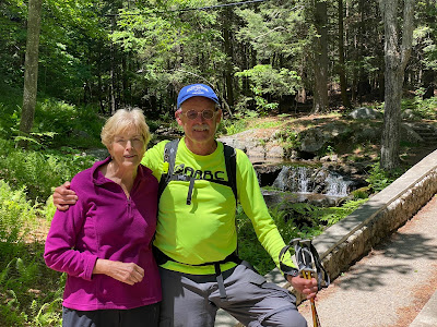
Join Kendall and me as we hike SRKG Trail 11 Mt Kearsarge Lincoln Trail from Rollins Park to Kearsarge Valley Road in Wilmot of five plus miles in 4 1/2 hours.
Join Kendall and me as we hike SRKG Trail 11 Mt Kearsarge Lincoln Trail from the summit of Mt Kearsarge in Rollins Park to Kearsarge Valley Road in Wilmot of five-plus miles in 4 1/2 hours.
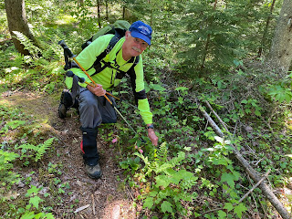
We completed the Lincoln Trail hike in two hikes. First, Kendall and Steve hiked from the Rollins Parking area down Mt Kearsarge and Black Mountain to Kearsarge Valley Road. A few days later, Steve returned to do a solo hike from the Rollins Parking area up the Lincoln Trail through its talus field to the summit of Mt Kearsarge. Kendall had hiked this talus field section of the Lincoln Trail many times.
The SRK Greenway Guide book rates Trail 11 as "Difficult."
I have hiked many times to the top of Mt Kearsarge. See the two below blog posts of one hike from Winslow State Park Parking area, and one from the Rollins Park area. Until today, I had not hiked the Lincoln Trail down to the southern trailhead on Kearsarge Valley Road in Wilmot.
Sunday morning, I met my friend Kendall at the southern trailhead on Kearsarge Valley Road. My wife drove us to Rollins State Park, where we started our return 5-mile hike on Lincoln Trail to the southern trailhead. We needed a pass, and a small fee to access the Rollins Parking area – all obtained at https://www.nhstateparks.org/visit/state-parks/rollins-state-park. After turning in our pass at the Kearsarge Mountain Road gate, we drove the 3-1/2 mile long uphill scenic auto road rising from the park entrance through woodlands to the parking and picnic areas.
 Starting at the Rollins parking area, where the Lincoln trail comes down from the summit, we enter the woods and go left per the SRKG trapezoid sign. We come to a fern-filled col between Black Mountain and Mt Kearsarge. Kendall has hiked this section in the spring, summer, fall, and winter. In the winter on snowshoes, using his compass and map, he diverts right from the Lincoln trail and bushwacks to where Kearsarge Valley Road meets Kearsarge Woods Road in Wilmot.
This marker means we are now on the Society for Protect of New Hampshire Forest's Black Mountain Forest Reservation. The SPNHF's property goes all the way until we meet the Link Trail, our final half-mile till Kearsarge Valley Road. The SRKG.org web site warned us to be on the lookout for the SPNHF clear-cutting and logging trucks – and maybe we would have to take an alternate trail. We did see a large sign when we met a gravel road, and warnings for the beginning of clear-cutting work, but nothing that required a detour. Of course, this was a Sunday morning.
At about 1.5 miles from Kearsarge road, we saw a sign for an Overlook.
We took the .15-mile spur to the Overlook and were not disappointed. We found a flying American flag, and after a short prayer for those who gave their lives for the freedom we enjoy, we saluted our beautiful country on this upcoming Independence Day. We saw the Country Club of New Hampshire Golf Course below us, and New London Ridge, Pleasant Lake, and local hills.
At 5.3 miles, the SRKG leaves the gravel road turns right onto the Link Trail. This last half mile goes through clear-cut and winding in the deep shade between hemlock trees and a field of immense glacial erratic boulders. The Link Trail ends at the trailhead on Kearsarge Valley Road.
Hiking SRKG Trail 11: Winslow State Park to Kearsarge Valley Road, is extra special to me. This trail encompasses hiking Mt Kearsarge, a mountain frequented by outdoor enthusiasts. Mt Kearsarge is the tallest of the three mountains (2,936′) in the Sunapee-Ragged-Kearsarge Greenway name and has been a favorite choice of mine whenever visitors come from out-of-state and want to climb a local New Hampshire mountain.
Winslow State Park and Rollins State Park are respectively situated in the northern and southern bases of the mountain. The entire mountain is within Kearsarge Mountain State Forest.
Accesses to the two-state Parks are from two different non-connected roads, but roads of the same name, Kearsarge Mountain Road, Warner, NH, and Kearsarge Mountain Road, Wilmot, NH.
I have hiked the mountain from both the Winslow and Rollins parks. Below you can see blog posts I recorded of two of my Mt Kearsarge treks. Each Park has a different perspective of the mountain.
One of the unique features of Mt Kearsarge is it can be seen from miles away. Its identifiable feature is a tower on its top.
The routes to the top touches four towns, Wilmot, Andover, Warner, and Sutton, and passes through two New Hampshire State Parks, Winslow and Rollins, and Mount Kearsarge State Forest.
We now, never have to say, "We wish we had hiked the SRKG Trail 11 from Rollins State Park via Lincoln Trail to Kearsarge Valley Road."
I have hiked many times to the top of Mt Kearsarge. See the two below blog posts of one hike from Winslow State Park Parking area, and one from the Rollins Park area. Until today, I had not hiked the Lincoln Trail down to the southern trailhead on Kearsarge Valley Road in Wilmot.
Sunday morning, I met my friend Kendall at the southern trailhead on Kearsarge Valley Road. My wife drove us to Rollins State Park, where we started our return 5-mile hike on Lincoln Trail to the southern trailhead. We needed a pass, and a small fee to access the Rollins Parking area – all obtained at https://www.nhstateparks.org/visit/state-parks/rollins-state-park. After turning in our pass at the Kearsarge Mountain Road gate, we drove the 3-1/2 mile long uphill scenic auto road rising from the park entrance through woodlands to the parking and picnic areas.
 Starting at the Rollins parking area, where the Lincoln trail comes down from the summit, we enter the woods and go left per the SRKG trapezoid sign. We come to a fern-filled col between Black Mountain and Mt Kearsarge. Kendall has hiked this section in the spring, summer, fall, and winter. In the winter on snowshoes, using his compass and map, he diverts right from the Lincoln trail and bushwacks to where Kearsarge Valley Road meets Kearsarge Woods Road in Wilmot.
Per the above LINCOLN TR. sign, we did have an option of taking a right turn at Rollins parking as seen SUMMIT .4 MI. hike arrow to the
summit of Mt Kearsarge. This section of
the Lincoln Trail is a very short hike, but a steep hike passing through a
talus field of huge broken rock fragments of rockfall from Mt Kearsarge’s
adjacent cliff faces. I completed this Lincoln Trail .4 mile section to the
summit another day, as seen in the below blog post The Lincoln Trail to the Summit of Mt Kearsarge.
This marker means we are now on the Society for Protect of New Hampshire Forest's Black Mountain Forest Reservation. The SPNHF's property goes all the way until we meet the Link Trail, our final half-mile till Kearsarge Valley Road. The SRKG.org web site warned us to be on the lookout for the SPNHF clear-cutting and logging trucks – and maybe we would have to take an alternate trail. We did see a large sign when we met a gravel road, and warnings for the beginning of clear-cutting work, but nothing that required a detour. Of course, this was a Sunday morning.
At about 1.5 miles from Kearsarge road, we saw a sign for an Overlook.
We took the .15-mile spur to the Overlook and were not disappointed. We found a flying American flag, and after a short prayer for those who gave their lives for the freedom we enjoy, we saluted our beautiful country on this upcoming Independence Day. We saw the Country Club of New Hampshire Golf Course below us, and New London Ridge, Pleasant Lake, and local hills.
At 5.3 miles, the SRKG leaves the gravel road turns right onto the Link Trail. This last half mile goes through clear-cut and winding in the deep shade between hemlock trees and a field of immense glacial erratic boulders. The Link Trail ends at the trailhead on Kearsarge Valley Road.
Hiking SRKG Trail 11: Winslow State Park to Kearsarge Valley Road, is extra special to me. This trail encompasses hiking Mt Kearsarge, a mountain frequented by outdoor enthusiasts. Mt Kearsarge is the tallest of the three mountains (2,936′) in the Sunapee-Ragged-Kearsarge Greenway name and has been a favorite choice of mine whenever visitors come from out-of-state and want to climb a local New Hampshire mountain.
Winslow State Park and Rollins State Park are respectively situated in the northern and southern bases of the mountain. The entire mountain is within Kearsarge Mountain State Forest.
Accesses to the two-state Parks are from two different non-connected roads, but roads of the same name, Kearsarge Mountain Road, Warner, NH, and Kearsarge Mountain Road, Wilmot, NH.
I have hiked the mountain from both the Winslow and Rollins parks. Below you can see blog posts I recorded of two of my Mt Kearsarge treks. Each Park has a different perspective of the mountain.
One of the unique features of Mt Kearsarge is it can be seen from miles away. Its identifiable feature is a tower on its top.
The routes to the top touches four towns, Wilmot, Andover, Warner, and Sutton, and passes through two New Hampshire State Parks, Winslow and Rollins, and Mount Kearsarge State Forest.
OutdoorSteve Blogs for Previous Mt Kearsarge Hikes
- Hiking Mt Kearsarge Winslow Park in Central New Hampshire
- Hiking Mt Kearsarge via Rollins Park on a Wet Foggy Day
 |
| SRKG Completion Medal |
We now, never have to say, "We wish we had hiked the SRKG Trail 11 from Rollins State Park via Lincoln Trail to Kearsarge Valley Road."
Sunapee-Ragged-Kearsarge Greenway (SRKG) Trails Hiked by OutdoorSteve and Friends - Click below links
++++++++++++++++++
"Everyone must do something. I believe I will go outdoors with family and friends"
Steve’s books are available as hardcopy and e-Books at Kindle and hardcopy at Morgan Hill Bookstore, New London, NH, Colby-Sawyer College, New London, NH, and Dartmouth-Hitchcock Gift Shop, Lebanon, NH.
Outdoor Play has trip preparations, routes, and narratives of bucket list places to go. The book will motivate friends and family to make the outdoors a key component of their daily life. If you want 5 or more books signed, send Steve an email and we can work out the logistics.

Additional Sources of Books at:
Hardcopyat: http://outdoorsteve.com and https://www.amazon.com/dp/098503842X
E-book at: https://www.amazon.com/dp/098503842X
- SRK Greenway Trail 1 Old Province Rd, Goshen to Newbury Harbor
- SRK Greenway Trail 2 Old Province Rd, Goshen to Sunapee Town Hall
- SRK Greenway Trail 3 Sunapee to Deerhill Springfield (Video featured on Bedford Community TV)
- SRK Greenway Trail 4 ProtectworthTrail, Springfield, NH
- SRK Greenway Trail 5 Springfield/New London to Great Brook Bridge
- SRK Greenway Trail 6 Great Brook Bridge to Wilmot 4A Wolf Trees and Trails
- SRK Greenway Trail 7 NH Route 4A to WilmotCenter
- SRK Greenway Trail 8 Wilmot Center to New Canada Road
- SRK Greenway Trail 9 New Canada Road to Proctor Academy
- SRK Greenway Trail 10 Proctor Academy to Winslow State Park Mt Kearsage
- SRK Greenway Trail 11 Rollins State Park via Lincoln Trail to Kearsarge Valley Road
- SRK Greenway Trail 12 – Kearsarge Valley Road to Wadleigh State Park
- SRK Greenway Trail 13 - Kezar Lake at Wadleigh Park to Chalk Pond
- SRK Greenway Trail 14 – Chalk Pond to Newbury
References
- Sunapee, Ragged, Kearsarge Greenway Web Site for Trail Maps and the SRK Greenway Trail Guide
- Winslow State Park
- Rollins State Park
- Hiking Eagle Pond, NH with Poet Laureate Donald Hall
- ORFS Hike Northern Rail Trail from PotterPlace Depot to Andover’s Softball field
- Sunapee Harbor Riverway
- Sunapee Harbor Riverwalk
- More Outdoor Steve Adventures
"Everyone must do something. I believe I will go outdoors with family and friends"
Steve’s books are available as hardcopy and e-Books at Kindle and hardcopy at Morgan Hill Bookstore, New London, NH, Colby-Sawyer College, New London, NH, and Dartmouth-Hitchcock Gift Shop, Lebanon, NH.
Outdoor Play has trip preparations, routes, and narratives of bucket list places to go. The book will motivate friends and family to make the outdoors a key component of their daily life. If you want 5 or more books signed, send Steve an email and we can work out the logistics.

Additional Sources of Books at:
Hardcopyat: http://outdoorsteve.com and https://www.amazon.com/dp/098503842X
E-book at: https://www.amazon.com/dp/098503842X


