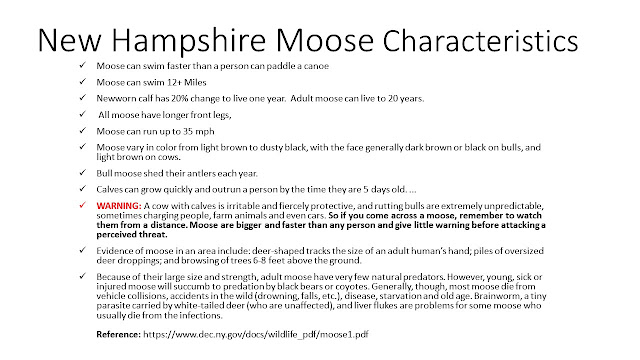
The Pittsburg–Chartierville Border Crossing connects the towns of Chartierville, Quebec, and Pittsburg, New Hampshire. The crossing can be reached by U.S. Route 3 on the American side and by Quebec Route 257 on the Canadian side. The last 18 miles to the Canadian border on the American side is the so-called Moose Alley because of its large moose population. The Great North Woods is located in Coos County.

Nolan uses kindling, flint, and steel (his pocket knife), and creates a spark for our dinner campfire.
 |
| Map of Republic of Indian Stream (1832 - 1836) Yielding to New Hampshire 1836 1842 Part of Pittsburg, NH |
 |
| Unique Moose Characteristics 2 of 2 |
Hiking to the Fourth Connecticut Lake and Headwaters of Connecticut River
From a small trickle to a mighty river
The Fourth
Connecticut Lake is a protected nature preserve located on the U.S. side of the
U.S./Canadian border. The Nature Conservancy holds a conservation easement that
safeguards the 78-acre preserve and the surrounding forest. The lake itself
resembles a small bog, but it is more accurately a northern acidic mountain
tarn — a small glacial pond. The small brook flowing from the pond is the start
of the 410-mile Connecticut River. Just as you can step back and forth between
Canada and the United States while climbing to the lake, you can step back and
forth across the Connecticut River at its humble beginning at Fourth Lake.
A short, moderately
steep climb takes you to the pond. The trailhead is located just behind the
U.S. Border Guard installation. Limited parking is located immediately south of
the guard station. Hikers do not have to check in with border guards before
accessing the trailhead.
The trail is made up
of granite boulders at certain spots, which can be wet and/or icy. It’s wise to
pay attention to your footing. The hike to Fourth Lake is .6 miles. Once there,
you’ll see trail markers for Loop Pond, a beautiful trail that circles Fourth
Lake and brings you to the spot where the Connecticut River begins. Round trip,
the hike, including the Loop Pond trail, is 1.7 miles and takes about two
hours.
The forest is
predominately balsam fir and delightfully fragrant. You’ll also find red
spruce, paper birch, and mountain ash. The edge of the pond is made up of a
floating bog of mosses, sedges, grasses and insectivorous plants like pitcher
plant. Look for wildflowers at the southern end of the pond. The pond supports
a small year-round fish population, river otter and beaver. Other wildlife
includes moose, white-tailed deer, black bear, spruce goose, and three-toed
woodpeckers.
Because this is a
conservation area, no dogs are allowed and there is no hunting, trapping or
fishing.
Fourth Connecticut Lake Vital Statistics
|
Surface Elevation |
2,670 feet |
|
Area |
2.5 acres |
|
Outflow |
There are two
outflows. Beaver activity determines which outflow becomes the Connecticut
River |
|
Location |
22 miles north of
Pittsburg off Route 3, at the U.S./Canadian border |
|
Average depth |
Between 2 and 4
feet |
|
Maximum depth |
5 feet |
Did You Know?
The
Connecticut River impacts four states — New Hampshire, Vermont, Massachusetts
and Connecticut — and feeds a series of large, cold-water lakes. It flows out
to sea at Long Island Sound. The waterway has been an essential part of New
England’s economy, used for transportation, log drives, a power source for
mills, farming and recreation.
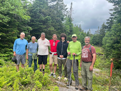
Nolan 2023 Graduation Camping Trip with Outdoor Steve!
https://mygonorth.com/things-to-do/hang-out-with-the-moose-at-these-3-moose-watching-spots-in-the-north-country/
Steve’s books are available as hardcopy and e-Books at Amazon's Kindle and hardcopy at Harborside Trading Company, 81 Main St, Sunapee, NH, Wild Goose Country Store, 77 Main St, Sunapee, NH, Morgan Hill Bookstore, New London, NH, Bookstore at Colby-Sawyer College, New London, NH, Dartmouth-Hitchcock Gift Shop, Lebanon, NH, and Village Sports, New London, NH.


