This blog describes seven friends doing a group endurance swim of nearly one mile at Perkins Pond, Sunapee, NH.
The swimmers, accompanied by a safety boat, go across the pond, around a raft, and then return back to the start. The swim takes approximately 40 minutes. The video describes the requirements the athletes meet before they swim with the group.
The maps, pictures, and video show snippets of the swim and will give you an “up front and personal” perspective.
The history of this swim started when my 7 and 8 year old boys, Shaun and Tim, asked to drive our 6 hp motor boat by themselves. Cathy and I knew the boys could swim, but if an emergency should occur in the boat, we were skeptical about their ability to swim a long time.
We told the boys they could only take the boat alone if they could swim across Perkins pond, and then swim back, all without a life vest. Of course we would accompany them by boat to insure their safety.
Our challenge proved to be an incentive for these young boys to improve and practice their swimming skills. Later that summer they fullfilled their swim agreement, and they were allowed to use the boat, wearing a life vest, by themselves.
Now, with close friends and family, we gather to repeat this original challenge.
Our seven swimmers in this blog post represent members of the Priest, Nestler and Scharff families.
Whether as a swimmer or supporter, enjoying the outdoors with friends and family is something you do to never have to say, “I wish I had swum across Perkins Pond."
Thursday, July 29, 2010


Friday, July 2, 2010
A Hike to Table Rock, Dixville, New Hampshire
Please join me in a hike to Table Rock in Dixville Notch, NH.
My wife Cathy and I spent an enjoyable three days at the magnificent Balsams Grand Hotel Resort, located in the great north woods of New Hampshire. Looking out the window from our room, I was enticed to hike to Table Rock.
Table Rock is without question the scariest, most spectacular overlook of my New Hampshire hiking experiences. Table Rock is the tip of a chiseled natural elevation that towers over the Dixville Notch highway. Table Rock jets out at the highest point of the Notch, seemingly a sentry guarding the Balsams property hundreds of feet below it. On a clear day, the view from Table Rock can include the mountains of Canada, Vermont, and Maine.
Reaching Table Rock requires a one plus hour hill climb on a narrow tree-canopied forest trail with 30 – 50% grades and rocks, roots, streams, and mud.
Please enjoy the video of my hike to Table Rock.
My wife Cathy and I spent an enjoyable three days at the magnificent Balsams Grand Hotel Resort, located in the great north woods of New Hampshire. Looking out the window from our room, I was enticed to hike to Table Rock.
Table Rock is without question the scariest, most spectacular overlook of my New Hampshire hiking experiences. Table Rock is the tip of a chiseled natural elevation that towers over the Dixville Notch highway. Table Rock jets out at the highest point of the Notch, seemingly a sentry guarding the Balsams property hundreds of feet below it. On a clear day, the view from Table Rock can include the mountains of Canada, Vermont, and Maine.
Reaching Table Rock requires a one plus hour hill climb on a narrow tree-canopied forest trail with 30 – 50% grades and rocks, roots, streams, and mud.
Please enjoy the video of my hike to Table Rock.
Thursday, June 24, 2010
Outdoor Enthusiast Campfire Chat: Starting Your Campfire with Rotten Birch Bark
Most campers know birch bark contains a combustible oil and will burn fiercely even when wet. We also know that it is not appropriate to peel bark from a live tree.
What was missing from my knowledge was whether old rotten and damp birch bark will still serve as kindle to quickly start a file.
During a recent hike in the Great North Woods of New Hampshire we passed through a swampy area with old blown down birches. They obviously had been lying on the floor of this forest for years. My friend thought overtime this downed tree had lost its combustible oil. I was not sure, and I never wanted to say, “I wish I had tried using rotten birch bark to start a camp fire”. Certainly, rather than wait to test this theory under emergency conditions, we should try it now.
See the below video on using rotten birch bark to start a camp fire.
What was missing from my knowledge was whether old rotten and damp birch bark will still serve as kindle to quickly start a file.
During a recent hike in the Great North Woods of New Hampshire we passed through a swampy area with old blown down birches. They obviously had been lying on the floor of this forest for years. My friend thought overtime this downed tree had lost its combustible oil. I was not sure, and I never wanted to say, “I wish I had tried using rotten birch bark to start a camp fire”. Certainly, rather than wait to test this theory under emergency conditions, we should try it now.
See the below video on using rotten birch bark to start a camp fire.
Friday, June 18, 2010
Outdoor Enthusiast Campfire Chat: How to Cook an Egg in an Onion
In my March 31, 2010 blog post, I Never Have to Say, “I wish I had paddled Florida’s Suwannee River”, I created a video showing John, our camp chief chef, cooking an egg in an orange over an open campfire.
A recent Great North Woods paddling and tenting trip to northern New Hampshire’s Lake Francis, allowed me to take my campsite experience a bit further. Paul Tawrell's outdoor enthusiast book, Wilderness Camping and Hiking, described a method to cook an egg over an open campfire in an onion. Being one to never say, "I wish I had cooked an egg in an onion over an open campfire", I decided to try Paul's recommendation.
Click the below video to see Outdoor Steve's experience with an onion, egg, and campfire.
A recent Great North Woods paddling and tenting trip to northern New Hampshire’s Lake Francis, allowed me to take my campsite experience a bit further. Paul Tawrell's outdoor enthusiast book, Wilderness Camping and Hiking, described a method to cook an egg over an open campfire in an onion. Being one to never say, "I wish I had cooked an egg in an onion over an open campfire", I decided to try Paul's recommendation.
Click the below video to see Outdoor Steve's experience with an onion, egg, and campfire.
Wednesday, March 31, 2010
I Never Have to Say, “I wish I had paddled Florida’s Suwannee River”

In late March, we spent five days paddling seventy miles of the upper Suwannee River. Dundee paddled his fifteen-foot aluminum Grumman canoe, Shaun was in an eleven-foot Old Town Cayuga kayak, and John and I in my sixteen-foot Old Town Penobscot canoe.
Florida has designate the Suwannee River as an Outstanding Florida Water. The Suwannee flows and winds 265 plus miles from the Okefenokee Swamp in southern Georgia to the Gulf of Mexico in Florida. It has fifty plus springs along the way. The river’s limestone outcroppings and a drop in elevation create Florida’s only whitewater rapids at Big Shoals and Little Shoals.
Put-In at Cyprus Creek South Tract

 My sister Barbara and husband Larry drove us to our put-in at Cyprus Creek South Tract in northern Florida where CR 6 crossed over the Suwannee River.
This was our first paddle in Florida, and we were not sure what to expect. Interestingly as the trip went on, we recognized similarities with our NH/ME/ treks, such as in New Hampshire we kept our eyes open for moose, whereas on the Suwannee we watched for alligators. In Maine we would admire stands of pine trees, while here in Florida we saw Spanish moss hanging from stately Cyprus and Live Oak trees. Our northern river paddles often passed through ledges and canyon-like sections, whereas in the Suwannee we experienced high bluffs of limestone walls funneling the river.

We frequently saw rope swings along the river. Summer had not yet come here, so we could only let our minds wander as to how much fun it would be to swing over the water, release, and drop into the cool Suwannee.
The upper and middle Suwannee is a dark brown-black color. This color is tannic acid released by decaying vegetation.
Our GPS showed the current to be around 3 miles per hour from our put-in through Big Shoals. Thereafter we noticed the current to be around 2 mph.
Day One – A Twenty miles Paddle to Big Shoals

Big Shoals is the Suwannee’s (and Florida) only set of rapids. Big Shoals was at Class III level, so we decided to portage (about a quarter mile carry). We camped on the bluff overlooking Big Shoals for the night. Click this video to enjoy our unique breakfast prepared by Chef John (or as we nicked him, Emeril Lagasse).
The below video shows the Big Shoals rapids, our superb breakfast, and our portage around Big Shoals.

Day Two – sixteen miles to Swift Creek camp
We did see four alligators, but as they lie on the banks they look like logs, and when they spot us, they quick slid into the water before we can get a picture. We spotted many large turtles throughout the trek. I spotted a river otter twice, but again they are quicker than my picture taking. Hawks, red cardinals, and vultures flew overhead. We heard what appeared to sound like Barred owls at night.
Ogeechee Tupelo Tree
As we paddled we noticed a tall odd-shaped tree that was similar in color to the Cyprus and height, but obviously was a different category. In planning for this trip Dundee and I visited his relative who had worked along the Suwannee, and he told us to be aware of the Ogeechee Tupelo tree near or in the water. The tree is unique to warm and wet areas in northern Florida, South Carolina and North Carolina. The trees we saw were close to 40 feet in height and with a spreading flat-topped crown. Multiple, irregular branches and roots emerged from their trunks. It had dark brown or grey, ridged bark, and the base of the tree had swollen buttress-type roots. We were told that local people often use its fruit to make jelly.
We noticed as we got closer to Big Shoals, the river bank changed to more rock than sand, and we stopped seeing Ogeechee Tupelo trees.
Admittedly, the Ogeechee Tupelo tree looked weird to us, and you can judge for yourself by playing the video we took.
Day Three to Swift Creek
We generally sought camp on the river between 4 and 5 pm. Edwin McCook, Land Management Specialist for the Suwannee River Water Management District, had given us maps and GPS points of preferred riverside camp sites, and these points came in handy in looking for a good night’s accommodation.
I spotted a three foot brown and tan spotted snake, but again no picture.

Day Four – fifteen miles to Holton Creek River Camp
The Suwannee River Wilderness Trail River Camps (SuwaneeRiver.com), such as Woods Ferry and Holton Creek, are spaced a day’s travel apart, and generally accessible only by the river of hiking trail. We stayed overnight at the Holton Creek River Camp, and its resident host, Ed, made our stay exceptional. We highly recommend these river camps.

We started noticing orange trail markers, similar to the painted white trail signs on the Appalachian Trail (AT). These markers signify The Florida National Scenic Trail (FNST). The 1400 mile trail comes across from Osceola National Forest to the Suwannee at Big Shoals on the east bank. It follows the east bank to White Springs and crosses the river at SR 136 Bridge and follows the north bank of the river to near Dowling Park in Twin Rivers State Forest where it turns west to the Florida panhandle. During our stay at Holton Creek, Shaun and I hiked two miles of the FNST.

 Sulpher springs on the Suwannee River were once promoted as a cure for almost any ailment. Today these sites are simply places of interest. At Suwannee Springs there is an old pool built out of limestone around a spring that was a resort in the late 1800’s and in the early 1900’s Folks would come and soak in the sulfur spring water for its healing properties.


Day Five – Thirteen Miles to Take-Out at Suwannee River State Park

Larry and his Dad met us at our take-out at Suwannee River State Park.
Enjoying the Suwannee – and more
This was a fabulous trip. We had only paddled in northern New England, and we were all pleasantly surprised with the ecology, cleanliness of the river shoreline and campsites, and its ecosystem with many birds, trees and animals. As northerners, we were a bit hesitant about being in alligator country, but we quickly learned gators were most likely to disappear when they saw humans.


Web site references are: Suwannee River Water Management District at www.mysuwanneeriver.com/, and Suwannee River Wilderness Trail at www.suwanneeriver.com/.
Learn about the Ogeechee Tupelo tree at www.audubonguides.com/species/Trees/Ogeechee-Tupelo.html
I definitely would consider doing the remaining 155 miles to the Gulf of Mexico. The Suwannee is a gem for a paddler’s delight.
I never want to say, "I wish I had paddled the Suwanee River to the Gulf of Mexico".
I never want to say, "I wish I had paddled the Suwanee River to the Gulf of Mexico".
Monday, March 15, 2010
A New Hampshire Winter Vacation…
Last week our two grandchildren (Madison 13 and Carson 10) from Kennesaw, Georgia, joined their Uncle Tim, Nana and Papa for an outdoor enthusiast week of skiing at Mount Sunapee, snow-shoeing to a beaver dam at Perkins Pond, a Celtics basketball game, and a tour of Fenway Park (Boston).
Madison (alpine skier) and Carson (snowboarder) skied last year for the first time. Both took lessons, and had three days of “falling, getting back up, and then trying it again”.
Day one this year was on the Mt Sunapee’s South Peak Learning Area on the beginner green trails. As the day progressed it became obvious their skills and confidence had sharpened from last year, and they finished the day taking the lift to the Summit Lodge.
Tim is truly an expert skier, and he served as their mentor for confidence and skill building. Days 2 and 3 were on the intermediate blue trails of the full mountain.
To get a sense of their skill level, click here for a video of Carson, Madison, and Tim making their way down South Peak. The end of the video has a brief snowshoe hike to the Perkins Pond beaver dam.
Ice Boat and Snow-shoeing through the Woods
Our friend Dundee called. He wanted to remove his ice boat from Perkins Pond because of the melting ice. He also asked if we wanted to snow shoe though the woods to a beaver dam on the Pond. This was an opportunity outdoor enthusiasts could turn down.
 Yes, snowshoes are essential tools for anyone whose life or living depends on the ability to get around in areas of deep and frequent snowfall. In additiion, snowshoes are used for winter recreation. Snowshoeing is easy to learn, and is a relatively safe and inexpensive recreational activity. As a reference to more information on snowshoeing click here.
Telemark/Backcountry practice and lessons
Yes, we were fans for our favorite skiers, BUT Outdoor Steve was not to be denied getting on his backcountry skis. Steve had not cross-country skied this season. To never say, “I wish I had XC skied this year”, he decided to practice his telemark turns on the “bunny hill”. Telemark skiing, popularized with a style of turn where one ski is advanced in front of the other and the heel was raised on the rear ski, with the skier in a very bent knee position .Day 1 was OK, as he began to feel comfortable after being off his skis for a year. Day 2 was frustrating, but at the end of the two hours of hiking up the hill, and tele (snow plowing to be truthful) down, Steve managed a few turns that “felt” like he was telemarking.
Day 3 started very frustrating and ending with a very positive Steve. As he snowplowed down the hill, he could not get the “feel” of a tele turn. Finally, after much rationalizing of whether to join Cathy in the lodge, he decided to ask if Sunapee did telemark instruction. A Sunapee instructor was watching the bunny slope skiers, so Steve asked him – turns out his name was Mike – and Mike said he taught telemark lessons. It was lucky day as Mike was the only telemark instructor at the Mountain.
Telemark skiing has been called "the world's oldest new sport”. Telemark skiing (or "tele") has also been called "the most rhythmic and flowing way to descend a snow covered mountain or backcountry trail." One thing I do know with absolute certainty: tele skiing is all about the stoke, the sensation, that feeling of excited exhilaration that comes from getting into the groove of the tele turn.
To paraphrase John Muir, telemark skiing gives access to places to play, places where nature may heal and give strength to body and soul, to interact with wildlife, to feel the forces of gravity, the energy of a gathering storm. A lot of tele skiers find a big part of the stoke to be in the friendships they develop with other members of the tribe, and for some a big attraction is the challenge of learning a new approach to skiing their local resort or terrain park. And then there are the philosophical, almost zen-like aspects to the sport.
While all of these things add to the fun of tele skiing, the true stoke is hard to describe. It can be an almost ethereal experience in those moments when everything comes together: form, function, time and space. Yet it is almost uncanny how something as intangible as this stoke can come to dominate a big part of so many of our lives. Frankly, I have yet to learn the tele stroke.
 Mike (right against Mt Sunapee background) had me try a few of my tele turns, and he immediate diagnosed one of my major flaws – I was using my uphill ski to “grab” the hill when turning, and I thus crossed my skis. Opps, away I fell. He demonstrated “my” snowplow, emphasizing its deficiency. He then demonstrated the turn with the uphill ski being kept flat on the turn. Now it was my turn to see if I learned from Mike. Walla, I made a decent snowplow. I practiced a few turns with Mike’s additional comments. I immediately felt a comfort level with Mike’s instructions – and certainly my turns. I was now ready to be shown the proper tele turn.
Mike had me parallel the hill as I moved one ski in front of the other while keeping both skis parallel. Mike quickly pointed out I did not raise my left heel. I could have sworn I had it raised, but when I looked down, it was only in my imagination. Mike certainly has excellent observation – and a very wonderful teaching manner.
My hour was up, and it was time to leave the hill. I doubt if I will make it back on snow this year, so hopefully, I this blog post will remind me of the instructions of Mike. If you want a wonderful telemark instructor, you can reach Mike at the Mt Sunapee Learning Center or at Eastman ‘s Recreation Center.
Boston Celtics
Tim made the kids week by a trip to see the Celtics plan the Minnesota Grizzlies. The results were not pleasing to Boston fans, but both Madison and Carson are star basketball players on their local teams. Seeing basketball at its best with Uncle Tim was quite a thrill.
Fenway Park
My grandson, Carson, is a left-handed Little League pitcher, and an avid Red Sox fan. He wanted to tour Fenway Park. Fenway is being prepared for the Red Sox April 4th opener. The field this year needed sod due to the ice hockey games Fenway hosted this winter.
Click this link for a brief video. Note the wolf-like animal in the outfield. Of course, this is a stuffed animal, and when asked our tour guide said the stuffed animals are used to keep the geese from eating the seed.
I cannot wait for next year for the grandkids to ski, and certainly for me to “practice” my tele stroke.
Never say, "I wish I had..."
I now never have to say, “I wish I had cross-country skied this year”.
Madison (alpine skier) and Carson (snowboarder) skied last year for the first time. Both took lessons, and had three days of “falling, getting back up, and then trying it again”.
Day one this year was on the Mt Sunapee’s South Peak Learning Area on the beginner green trails. As the day progressed it became obvious their skills and confidence had sharpened from last year, and they finished the day taking the lift to the Summit Lodge.
Tim is truly an expert skier, and he served as their mentor for confidence and skill building. Days 2 and 3 were on the intermediate blue trails of the full mountain.
To get a sense of their skill level, click here for a video of Carson, Madison, and Tim making their way down South Peak. The end of the video has a brief snowshoe hike to the Perkins Pond beaver dam.
Ice Boat and Snow-shoeing through the Woods
Our friend Dundee called. He wanted to remove his ice boat from Perkins Pond because of the melting ice. He also asked if we wanted to snow shoe though the woods to a beaver dam on the Pond. This was an opportunity outdoor enthusiasts could turn down.

Telemark/Backcountry practice and lessons
Yes, we were fans for our favorite skiers, BUT Outdoor Steve was not to be denied getting on his backcountry skis. Steve had not cross-country skied this season. To never say, “I wish I had XC skied this year”, he decided to practice his telemark turns on the “bunny hill”. Telemark skiing, popularized with a style of turn where one ski is advanced in front of the other and the heel was raised on the rear ski, with the skier in a very bent knee position .Day 1 was OK, as he began to feel comfortable after being off his skis for a year. Day 2 was frustrating, but at the end of the two hours of hiking up the hill, and tele (snow plowing to be truthful) down, Steve managed a few turns that “felt” like he was telemarking.
Day 3 started very frustrating and ending with a very positive Steve. As he snowplowed down the hill, he could not get the “feel” of a tele turn. Finally, after much rationalizing of whether to join Cathy in the lodge, he decided to ask if Sunapee did telemark instruction. A Sunapee instructor was watching the bunny slope skiers, so Steve asked him – turns out his name was Mike – and Mike said he taught telemark lessons. It was lucky day as Mike was the only telemark instructor at the Mountain.
Telemark skiing has been called "the world's oldest new sport”. Telemark skiing (or "tele") has also been called "the most rhythmic and flowing way to descend a snow covered mountain or backcountry trail." One thing I do know with absolute certainty: tele skiing is all about the stoke, the sensation, that feeling of excited exhilaration that comes from getting into the groove of the tele turn.
To paraphrase John Muir, telemark skiing gives access to places to play, places where nature may heal and give strength to body and soul, to interact with wildlife, to feel the forces of gravity, the energy of a gathering storm. A lot of tele skiers find a big part of the stoke to be in the friendships they develop with other members of the tribe, and for some a big attraction is the challenge of learning a new approach to skiing their local resort or terrain park. And then there are the philosophical, almost zen-like aspects to the sport.
While all of these things add to the fun of tele skiing, the true stoke is hard to describe. It can be an almost ethereal experience in those moments when everything comes together: form, function, time and space. Yet it is almost uncanny how something as intangible as this stoke can come to dominate a big part of so many of our lives. Frankly, I have yet to learn the tele stroke.

Mike had me parallel the hill as I moved one ski in front of the other while keeping both skis parallel. Mike quickly pointed out I did not raise my left heel. I could have sworn I had it raised, but when I looked down, it was only in my imagination. Mike certainly has excellent observation – and a very wonderful teaching manner.
My hour was up, and it was time to leave the hill. I doubt if I will make it back on snow this year, so hopefully, I this blog post will remind me of the instructions of Mike. If you want a wonderful telemark instructor, you can reach Mike at the Mt Sunapee Learning Center or at Eastman ‘s Recreation Center.
Boston Celtics
Tim made the kids week by a trip to see the Celtics plan the Minnesota Grizzlies. The results were not pleasing to Boston fans, but both Madison and Carson are star basketball players on their local teams. Seeing basketball at its best with Uncle Tim was quite a thrill.
Fenway Park
My grandson, Carson, is a left-handed Little League pitcher, and an avid Red Sox fan. He wanted to tour Fenway Park. Fenway is being prepared for the Red Sox April 4th opener. The field this year needed sod due to the ice hockey games Fenway hosted this winter.
Click this link for a brief video. Note the wolf-like animal in the outfield. Of course, this is a stuffed animal, and when asked our tour guide said the stuffed animals are used to keep the geese from eating the seed.
I cannot wait for next year for the grandkids to ski, and certainly for me to “practice” my tele stroke.
Never say, "I wish I had..."
I now never have to say, “I wish I had cross-country skied this year”.
Saturday, February 20, 2010
Deep Travel & Way down upon the Suwannee River
I am preparing to paddle the Suwannee River!
On October 16, 2009 I posted a blog on my hike along the Suwannee River, Paddle Florida - Get Down on the Suwannee River, and Go with the Flow! A call followed from my friend Dundee saying he wanted to paddle the Suwannee. My response was, “If you organize it, I will go”. Well, March 22 through March 26, Dundee, John, Shaun (my son) and I are paddling 70 miles of the 266 miles of the Suwannee River.

Planning the Trip
For the past few months, under Dundee’s leadership, we Googled the "Suwannee River", read William A. Logan’s, Canoeing and Camping the 213 miles of The Beautiful Suwannee River, and watched Logan's DVD. My sister Barbara and husband Larry introduced me to the lore of the Suwannee River - and Barbara has provided contacts and maps from the Suwannee River Management District Department of Land Acquisition and Management. The White Springs water level is used to determine the water conditions. In my email correspondence with Edwin McCook, SRMD Land Management Specialist, he says, "I like to paddle the river between 50’ and 60’ at White Springs."
Last week Dundee and I went to Vermont to visit with his cousin Arthur. Arthur is a retired biologist who had responsibly in the Suwannee River area, and he readily shared sights of interest, warnings, and camping suggestions (i.e. firewood is plentiful, check the water level at White Springs before you start, "alligators will not bother you", etc).
Deep Travel

"At its simplest, deep travel is about heightened awareness. It is careful looking. It is paying attention to what is around you. Deep travel demands that we immerse ourselves fully in places and realize that they exist in time as well as space. A deep traveler knows the world is four-dimensional and can’t be experienced with eyes and ears only.
Deep travel is not so much a matter of seeing sights as it is sight seeking. It is a searching for the patterns and juxtapositions of culture and nature and delighting in the incongruities left by the inexorable passage of time. Deep travelers revel in the wild, inspiring call of a kingfisher as it flies over a couple of trolling anglers with Bud longnecks in one hand and rods in the other. They savor the sight of a tree shaded burial ground squeezed between big-box retailers on a traffic chocked commercial strip.
Deep travelers look not so much for scenery or enchanting objects as for a tapestry of comprehension woven from stone walls, retail establishments, street and topographical names, transportation networks, building styles, plant and animal assemblages, advertising signs, and other artifacts. Each element makes a statement about the landscape as a whole and the relationship of one part to another. Together, they tell a story. Deep travel is an ecological way of looking where everything we see has a function and all the parts are related, no matter how seemingly disparate or contradictory.
Like animals that remain intensely aware of their surroundings and any alteration to them because predation or starvation await the unwary, deep travelers work to be keenly conscious of their environs. They strive for the alertness and acuity of wildland firefighters or solders whose survival depends on their knowledge of topography, history, weather, vegetation, and the observance of changes in minute phenomena. Such mindfulness simultaneously enriches experience and makes the voyager worth of the journey."
I read David’s book, and in particular the above section, and realized the Suwannee was my chance to improve my deep traveler skills. My friend Dundee is a deep traveler and he always “stops to smell the roses” and appreciate the moment of the forests, animals, flora and sky. Me, I need to remind myself to be a deep traveler, and as David says, “At its simplest, deep travel is about heightened awareness. …..A deep traveler knows the world is four-dimensional and can’t be experienced with eyes and ears only.”
I welcome your comments - certainly, there will be a follow-up post. I never want to say, "I wish I had been a deep traveler on the Suwannee River."
Friday, January 29, 2010
Dreaming the Appalachian Trail
The Man - Brad Viles
 I encourage you to read Brad Viles's book, Dreaming the Appalachian Trail. I write this blog in admiration for a man I have never met in person. We have corresponded via email, have chatted on the phone, and have exchanged books. Indeed, I have read many of his writings in the Bangor Daily News.
I was so enthralled with Dreaming … that I just had to have my wife Cathy listen as I read her two chapters of beautiful prose that reminded me of reading Robert Frost’s, “Two roads diverged in the woods, and I took the one less traveled by”. I pictured Brad reading to an intent group of outdoor enthusiasts by a campfire next to a river in Maine.
Snippets from Contents of Dreaming
Dreaming the Appalachian Trail is a fictional account of Brad’s Appalachian Trail (AT) hike from Georgia to Maine. Along the way he encounters violent storms, strange people, spectacular scenery and events that change his life. The trail itself is a major character in this story of imagination and wonder.
I absolutely loved Non-stop’s frog/tadpole metaphor. “A frog can’t explain to a tadpole what he will become when grown. The tadpole can’t understand about having legs, no tail and breathing air, even though a frog is exactly what the tadpole would become when it’s an adult. I could not express to anyone what it was like to walk over two thousand miles, so I was a frog, surrounded by tadpoles.” Gosh, I read that, and said, there is my answer when people ask me what it is like to paddle 100 miles on the Allagash Wilderness Waterway.
The Voice made me pause and feel Maine-tainer merge with the “AT”. I ask myself, hmm, so that is what it is like to have the AT talk to me.
Topo Man made my imagination go wild, and his appearance with Compass was unexpected and appropriate. I could see a person tattooed from head to foot with the map of the AT, and yet this person was always losing his way on the AT.
If you want a book to tell you directions and points of interest on the AT, as most AT books do, then this book is not for you. If you want to "feel" this man's connection to the AT, if you want to be absorbed and believe an AT hike, and if you want to read poetry, then buy Dreaming the Appalachian Trail.
I felt so moved after reading Dreaming the Appalachian Trail I posted a five-star(*****)review on Amazon.com
Purchase Dreaming the Appalachian Trail
To buy Dreaming... ($10.00 72 pages) go to Amazon.com
Brad writings include special outdoor enthusiast columns describing his personal exploits. You can read his outdoor pieces by Googling keywords, “Brad Viles Maine”.
Enthusiast passes on tips, stories, love of outdoors
In the January 16, 2010 issue of the Bangor Daily news, Brad wrote a book review of Outdoor Enthusiast titled, Enthusiast passes on tips, stories, love of outdoors. Click here to read it.
An Invitation to Hike Acadia National Park
Brad and I do plan on meeting in person. Brad has graciously invited me to join him in hiking his special trails in the Acadia National Park of Maine. In fact, as I shared Brad’s invitation with my own “characters’ in Outdoor Enthusiast, many have asked if they might join us. Maybe if Brad reads this blog he will smile like his AT trail name of “Maine-tainer”, and I can introduce him to three or four of my fellow outdoor enthusiasts.
My Maine Connection
In the process of interviewing me for his BDN article, I recalled my Maine adventures - after all this review is for "Mainers”. Gosh, I am really connected! Not only was my Dad from Maine, I have aunts and cousins throughout Maine, and we are doing a genealogy search to verify my great great grandmother was indeed a Penobscot Indian.
Moreover, Outdoor Enthusiast describes seven paddling treks in Maine including the Allagash, the Kenduskeag Stream Canoe Race (with my TV dump at Six-mile Falls), Kennebunk Fireman Triathlon, Kennebec White Water Rafting, and the Androscoggin Trek to the Sea. My Maine club memberships are the Appalachian Mountain Club and the Maine Island Trail Association.
I trust my motivational presentation at the Naval Ship Yard Kittery encouraged sailors to enjoy Maine’s outdoor opportunities. Chapter Eleven of Outdoor Enthusiast has Places to Play in Northern New England - the Maine Way
Be sure to never say, “I wish I had spent $10.00 to read, Dreaming the Appalachian Trail

I was so enthralled with Dreaming … that I just had to have my wife Cathy listen as I read her two chapters of beautiful prose that reminded me of reading Robert Frost’s, “Two roads diverged in the woods, and I took the one less traveled by”. I pictured Brad reading to an intent group of outdoor enthusiasts by a campfire next to a river in Maine.
Snippets from Contents of Dreaming
Dreaming the Appalachian Trail is a fictional account of Brad’s Appalachian Trail (AT) hike from Georgia to Maine. Along the way he encounters violent storms, strange people, spectacular scenery and events that change his life. The trail itself is a major character in this story of imagination and wonder.
I absolutely loved Non-stop’s frog/tadpole metaphor. “A frog can’t explain to a tadpole what he will become when grown. The tadpole can’t understand about having legs, no tail and breathing air, even though a frog is exactly what the tadpole would become when it’s an adult. I could not express to anyone what it was like to walk over two thousand miles, so I was a frog, surrounded by tadpoles.” Gosh, I read that, and said, there is my answer when people ask me what it is like to paddle 100 miles on the Allagash Wilderness Waterway.
The Voice made me pause and feel Maine-tainer merge with the “AT”. I ask myself, hmm, so that is what it is like to have the AT talk to me.
Topo Man made my imagination go wild, and his appearance with Compass was unexpected and appropriate. I could see a person tattooed from head to foot with the map of the AT, and yet this person was always losing his way on the AT.
If you want a book to tell you directions and points of interest on the AT, as most AT books do, then this book is not for you. If you want to "feel" this man's connection to the AT, if you want to be absorbed and believe an AT hike, and if you want to read poetry, then buy Dreaming the Appalachian Trail.
I felt so moved after reading Dreaming the Appalachian Trail I posted a five-star(*****)review on Amazon.com
Purchase Dreaming the Appalachian Trail
To buy Dreaming... ($10.00 72 pages) go to Amazon.com
Brad writings include special outdoor enthusiast columns describing his personal exploits. You can read his outdoor pieces by Googling keywords, “Brad Viles Maine”.
Enthusiast passes on tips, stories, love of outdoors
In the January 16, 2010 issue of the Bangor Daily news, Brad wrote a book review of Outdoor Enthusiast titled, Enthusiast passes on tips, stories, love of outdoors. Click here to read it.
An Invitation to Hike Acadia National Park
Brad and I do plan on meeting in person. Brad has graciously invited me to join him in hiking his special trails in the Acadia National Park of Maine. In fact, as I shared Brad’s invitation with my own “characters’ in Outdoor Enthusiast, many have asked if they might join us. Maybe if Brad reads this blog he will smile like his AT trail name of “Maine-tainer”, and I can introduce him to three or four of my fellow outdoor enthusiasts.
My Maine Connection
In the process of interviewing me for his BDN article, I recalled my Maine adventures - after all this review is for "Mainers”. Gosh, I am really connected! Not only was my Dad from Maine, I have aunts and cousins throughout Maine, and we are doing a genealogy search to verify my great great grandmother was indeed a Penobscot Indian.
Moreover, Outdoor Enthusiast describes seven paddling treks in Maine including the Allagash, the Kenduskeag Stream Canoe Race (with my TV dump at Six-mile Falls), Kennebunk Fireman Triathlon, Kennebec White Water Rafting, and the Androscoggin Trek to the Sea. My Maine club memberships are the Appalachian Mountain Club and the Maine Island Trail Association.
I trust my motivational presentation at the Naval Ship Yard Kittery encouraged sailors to enjoy Maine’s outdoor opportunities. Chapter Eleven of Outdoor Enthusiast has Places to Play in Northern New England - the Maine Way
Be sure to never say, “I wish I had spent $10.00 to read, Dreaming the Appalachian Trail
Friday, January 8, 2010
Let's Go Spinning!
“Do you want to go spinning?” my friend Dick asked. My first response was, “I do not do yarn”.

So what is spinning? For an outdoor enthusiast, spinning is a bicycle aerobic exercise that can either take place on a specially designed stationary bike-like device called (obviously enough) a spinning bike, or, you can put your own bicycle in a climbing block and stationary trainer, and pedal nowhere.
A perfect time for spinning is on a cold, windy, snowy night in the middle of a New Hampshire winter. What a great time to meet friends, get cardio exercise, learn the secrets of pedaling from experts, and adjust your bike’s hardware. I attend an evening one hour indoor cycling spinning class at Nault’s Cyclery in Manchester. (www.naultsbikeshop.com/)
First, let me stress this class is not for the novice bicyclist. The pace of the class is aimed at experienced bicyclists preparing for spring competition and long outdoor mileage. I use this class to be ready for my June triathlons (http://www.trinaults.com/).

The class is lead by Jack, a USAC Level III Coach (www.usacycling.org/). As we pedal with motivating beat music in the background, Jack talks us through a visualization of an outdoor cycling workout: "You're going up a long hill now, you can't see the top yet.…"
During the class you vary your pace -- sometimes pedaling at a high cadence, other times cranking up the gear level, and even pedaling from a standing position. We do routines that are designed to simulate terrain and situations similar to riding a bike outdoors. Some of the movements and positions include h.JPG) ill climbs, sprints and interval training.
ill climbs, sprints and interval training.
Nault’s bike shop provides space for our twice weekly “bike ride”. The staff even helps with minor equipment adjustments, such as helping me when my cadence meter was not registering and assisting me when my handlebars needed a more efficient alignment. Without Nault’s continued support this class would not be possible.
Jack hardily encourages us to drink plenty of water. Indoor cycling is very energetic and causes a lot of sweating, and a person can easily get dehydrated. Spinning burns serious calories and offers an awesome aerobic workout that makes your heart pump fast. It also tones your quadriceps and outer thigh muscles. Because you stay in one place with the same basic movement throughout, spinning makes it easier to concentrate on your form than in an outdoor environment.
 We follow Jack’s encouragement and instruction: “pedal with only your left leg for one minute, one minute slow pedaling both legs, and then pedal with the left leg for one minute.”
To get more information on spinning go to http://yourtotalhealth.ivillage.com/diet-fitness/spinning-101.html and Indoor Cycling Tips and Training
What do I bring to the class?
• My bicycle and my bike shoes
• A water of bottle (I am definitely going to sweat.)
• Hat or sweat band
• Towel for wiping away sweat
• Power meters and heart rate monitors are encouraged
• Padded bicycle shorts
I now, never have to say, “I wish I had done winter spinning.”

So what is spinning? For an outdoor enthusiast, spinning is a bicycle aerobic exercise that can either take place on a specially designed stationary bike-like device called (obviously enough) a spinning bike, or, you can put your own bicycle in a climbing block and stationary trainer, and pedal nowhere.
A perfect time for spinning is on a cold, windy, snowy night in the middle of a New Hampshire winter. What a great time to meet friends, get cardio exercise, learn the secrets of pedaling from experts, and adjust your bike’s hardware. I attend an evening one hour indoor cycling spinning class at Nault’s Cyclery in
 Manchester. (www.naultsbikeshop.com/)
First, let me stress this class is not for the novice bicyclist. The pace of the class is aimed at experienced bicyclists preparing for spring competition and long outdoor mileage. I use this class to be ready for my June triathlons
 (http://www.trinaults.com/).
The class is lead by Jack, a USAC Level III Coach (www.usacycling.org/). As we pedal with motivating beat music in the background, Jack talks us through a visualization of an outdoor cycling workout: "You're going up a long hill now, you can't see the top yet.…"
During the class you vary your pace -- sometimes pedaling at a high cadence, other times cranking up the gear level, and even pedaling from a standing position. We do routines that are designed to simulate terrain and situations similar to riding a bike outdoors. Some of the movements and positions include h
.JPG) ill climbs, sprints and interval training.
ill climbs, sprints and interval training.Nault’s bike shop provides space for our twice weekly “bike ride”. The staff even helps with minor equipment adjustments, such as helping me when my cadence meter was not registering and assisting me when my handlebars needed a more efficient alignment. Without Nault’s continued support this class would not be possible.
Jack hardily encourages us to drink plenty of water. Indoor cycling is very energetic and causes a lot of sweating, and a person can easily get dehydrated. Spinning burns serious calories and offers an awesome aerobic workout that makes your heart pump fast. It also tones your quadriceps and outer thigh muscles. Because you stay in one place with the same basic movement throughout, spinning makes it easier to concentrate on your form than in an outdoor environment.
 We follow Jack’s encouragement and instruction: “pedal with only your left leg for one minute, one minute slow pedaling both legs, and then pedal with the left leg for one minute.”
To get more information on spinning go to http://yourtotalhealth.ivillage.com/diet-fitness/spinning-101.html and Indoor Cycling Tips and Training
What do I bring to the class?
• My bicycle and my bike shoes
• A water of bottle (I am definitely going to sweat.)
• Hat or sweat band
• Towel for wiping away sweat
• Power meters and heart rate monitors are encouraged
• Padded bicycle shorts
I now, never have to say, “I wish I had done winter spinning.”
Saturday, November 28, 2009
Springer Mountain, Georgia - The Southern Terminus of the Appalachian Trail
Along with my sons Shaun and Tim, I visited Springer Mountain, Georgia, the southern end of the Appalachian Trail (AT). The Appalachian Trail Conservatory estimates the AT to be 2,175 miles, but yearly the figure changes with land ownership and route changes. I have no urge to hike all of the AT (at least at this time), but given I was spending a month in Georgia, and I have hiked a great deal of the trail in New Hampshire, Maine, and Vermont, I could not resist hiking the Georgia finishing point of the AT to see the two rock-embedded plaques. Some folks believe the AT was an Indian trail. That assumption is not true. In 1922 Benton MacKaye, a forester from Massachusetts, had the vision of a continuous hiking trail from Georgia to Maine. A single AT was recognized in 1937 and is maintained by thirty-two non-profit organizations.
Less than twenty-five percent of through hikers - those who start from one end of the trail to the other - complete the entire trail. A thru-hiker can start at either of the trail's termini/starts - Mount Katahdin, Maine or Springer Mountain, Georgia.
The final mile of the AT passes through Forest Service Road (FSR) 42 near the top of Springer Mountain. From the small parking lot, you cross the FSR dirt road, and follow an AT wooden trail sign (with .9 miles engraved) and vertical white rectangular trail paint marks to its termination atop Springer Mountain. Visitors to the top of Springer Mountain can sign a logbook stored in a metal box encased in a rock holding one of the plaques.

Benton MacKaye Trail
As we returned to the parking lot, we encountered the Benton MacKaye Trail.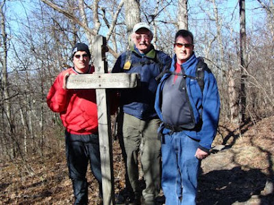 This is a four and ½-mile spur off the AT that essentially brings you back to the Spring Mountain parking lot. In tribute to Benton MacKaye, we decided to take this trail to return to the parking lot.
Directions
It took many MapQuest searches, a few Google Earth reviews, and many Google Maps, before I found specific enough directions to Springer Mountain, the southern end of the AT. Click here see the Directions we took to reach the Springer Mountain parking lot from Kennesaw, GA. (note: There are other ways to get to the parking lot.) The Springer Mountain parking lot is located in the Chattahoochee National Forest nine-tenths (.9) miles from the top of Springer Mountain, where two rock-embedded plaques denote the southern end of the AT.
Ten point four miles of a Wildness Road
Our last ten plus miles to the Springer Mountain parking lot were on a one-lane rock infested and mud hole red dirt mountain road. Our bumpy ten mile per hour pace was jarring. We frequently had to pull off the road for on-coming cars. The road was literally cut into the side of the mountain with tall Georgia pines on each side. You surely need a four-wheel drive or SUV to use this route.
Resources for AT history, maps, planning and through-hiker experiences
A great resource to learn about the history of the AT, state by state trail maps, and how to plan the hike, can be located at www.appalachiantrail.org/
It takes the average AT hiker six months to finish the entire trail.
Never Say, “I wish I had…”
Shaun, Tim and I now, never have to say, “We wish we had been to the southern end of the AT.”
A Holiday Gift for the Outdoor Enthusiast
Give Outdoor Enthusiast: Never say, "I wish I had ..." as a special gift for the holidays. www.Amazon.com/
Some folks believe the AT was an Indian trail. That assumption is not true. In 1922 Benton MacKaye, a forester from Massachusetts, had the vision of a continuous hiking trail from Georgia to Maine. A single AT was recognized in 1937 and is maintained by thirty-two non-profit organizations.Less than twenty-five percent of through hikers - those who start from one end of the trail to the other - complete the entire trail. A thru-hiker can start at either of the trail's termini/starts - Mount Katahdin, Maine or Springer Mountain, Georgia.
The final mile of the AT passes through Forest Service Road (FSR) 42 near the top of Springer Mountain. From the small parking lot, you cross the FSR dirt road, and follow an AT wooden trail sign (with .9 miles engraved) and vertical white rectangular trail paint marks to its termination atop Springer Mountain. Visitors to the top of Springer Mountain can sign a logbook stored in a metal box encased in a rock holding one of the plaques.


Benton MacKaye Trail
As we returned to the parking lot, we encountered the Benton MacKaye Trail.
 This is a four and ½-mile spur off the AT that essentially brings you back to the Spring Mountain parking lot. In tribute to Benton MacKaye, we decided to take this trail to return to the parking lot.
Directions
It took many MapQuest searches, a few Google Earth reviews, and many Google Maps, before I found specific enough directions to Springer Mountain, the southern end of the AT. Click here see the Directions we took to reach the Springer Mountain parking lot from Kennesaw, GA. (note: There are other ways to get to the parking lot.) The Springer Mountain parking lot is located in the Chattahoochee National Forest nine-tenths (.9) miles from the top of Springer Mountain, where two rock-embedded plaques denote the southern end of the AT.
Ten point four miles of a Wildness Road
Our last ten plus miles to the Springer Mountain parking lot were on a one-lane rock infested and mud hole red dirt mountain road. Our bumpy ten mile per hour pace was jarring. We frequently had to pull off the road for on-coming cars. The road was literally cut into the side of the mountain with tall Georgia pines on each side.
 You surely need a four-wheel drive or SUV to use this route.
Resources for AT history, maps, planning and through-hiker experiences
A great resource to learn about the history of the AT, state by state trail maps, and how to plan the hike, can be located at www.appalachiantrail.org/
It takes the average AT hiker six months to finish the entire trail.
Never Say, “I wish I had…”

Shaun, Tim and I now, never have to say, “We wish we had been to the southern end of the AT.”
A Holiday Gift for the Outdoor Enthusiast
Give Outdoor Enthusiast: Never say, "I wish I had ..." as a special gift for the holidays. www.Amazon.com/
Subscribe to:
Posts (Atom)


