Four friends spent four days paddling the Clyde and Nulhegan Rivers and Spectacle Pond – parts of what the NFCT calls section 6. Island Pond is the highest point in the NFCT and serves as the headwaters for the Clyde River, which flows 40-miles northwest to Lake Memphremagog and leads to the Saint Lawrence River.
Island Pond, through Spectacle Pond, is also the
headwaters for the Nulhegan River, which flows east to the Connecticut River.


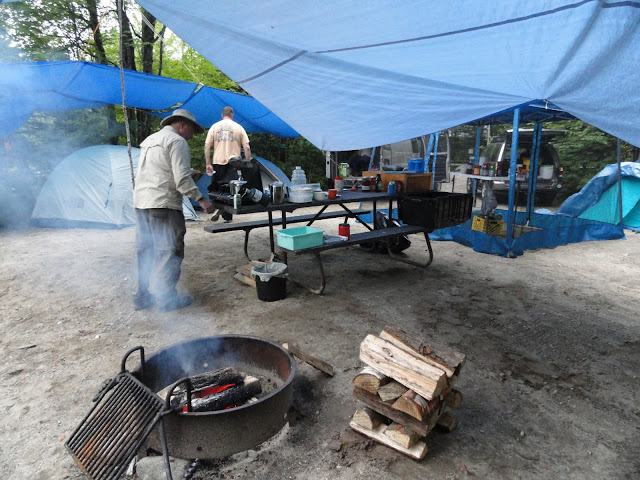
On Day One the Clyde River water was clear and moving slowly from our Island Pond put-in to Ten Mile Square Road take-out. Paddling from Island Pond to Five Mile Square Road was five miles of zigzagging and took us about four hours. We overcame many obstacles such as down trees in the river, beaver dams, Class I-II boulder fields from a washed out logging-era dam, and walls of wood debris and blow-downs. The water level exposed many of the felled trees and was a challenge to our kayak and canoeing skills to overcome these barriers without portaging. The width of the river from Island Pond to Ten Mile Square Road was narrow (ten to twenty feet wide).
Day Two was an all-day drenching soaking rainstorm, and we only managed a brief evening paddle on beautiful Spectacle Pond passing the NFCT sign to portage to the Nulhegan River.
On Day Three we continued from our Ten Mile Square Road take-out nine miles to Pensioner Pond. Certainly the previous days deluge had an impact on the Clyde’s width and speed with overflows with high water levels. We estimated a 3 to 4 mph current that really moved. This Day Three section had more marsh and fewer trees than Day One from Island Pond to Ten Mile Square.
We used the highly recommended NFCT online Trip Planner (http://www.northernforestcanoetrail.org/tripplanner/) to plan and map our trip. We also purchased the NFCT Lake Memphremagog to Connecticut River Section 6 water protected map - and referred to it frequently throughout our paddle.
How long does it take to paddle from Island Pond to Five Mile Square Road, and then to Ten Mile Square Road? How long does it take to paddle from Ten Mile Square Road to Pensioner Pond? The Island Pond to Upper Clyde reference (http://www.northernforestcanoetrail.org/media/Island_Pond_And_The_Upper_Clyde.pdf) has a very good Trip Summary of paddling miles and times.
Want to know what it feels like to paddle the Clyde River? What does the country side look like? What obstacles may be encountered? Want to see Tim, John and Dundee paddle a short section of Class I – II boulder field rapids?
Usually, as we approach log dams and other barriers in the
river, we slow and check the area for our approach, and then go through one
person at a time, waiting to make sure each person safely gets across before
the next person goes. We stop before the rapids and scout the best way to go
through the rapids when we know rapids are ahead.
About four miles from our put-in at Island Pond, I was the
first person through one of the many fallen trees blocking the river, and I
intended to paddle clear of this obstacle and wait for my fellow paddlers.
However, the fallen tree was on a bend, and when I made it through the barrier,
I immediately found myself in Class II white water without a
place to pull out and wait for the next paddler.
Essentially I was committed to these rapids with boulders and small drops, not really knowing how rough they were nor how long they would last. I was safely able to make it through this two hundred yard set of rapids – and my friends did likewise.

So what is the Northern Forest Canoe Trail (NFCT)?
The NFCT is a living reminder of when rivers were both highways and routes of communications; the Trail is a celebration of the Northern Forest. The Trail is 740 miles of historic waterway traveled by Native Americans. It begins/ends in Fort Kent Maine, and travels through Maine, New Hampshire, Vermont, Quebec, and ending/beginning in Old Forge, New York. http://www.northernforestcanoetrail.org.

The NFCT is a journey through the landscape of the northeast. The land speaks of its history – of rocks and ruins, people and plants, and natural and economic forces at play.
The sections of the NFCT that friends and I have paddled are:
- The Allagash Wilderness Waterway
- Lake Umbagog: Androscoggin River
- Lake Memphremagog
- Connecticut River
- Moose River and Attean Pond on the historic “Moose River Bow Trip”
- Umbazooksus Stream
- Clyde River, Nulhegan River, and Spectacle Pond
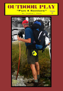
See my NFCT travels in my recent book, Outdoor Play "Fun 4 4 Seniors" (http://www.outdoorsteve.com) and my blog, (http://outdooradventurers.blogspot.com/)
Four Days in Northern New Hampshire with Family and Friends Hiking, Paddling, Tenting and Moose Sighting. http://outdooradventurers.blogspot.com/2012/07/four-days-in-new-hampshire-of-family.html
Exploring Lake Umbagog – a Gem in the Great North Woods http://outdooradventurers.blogspot.com/2010/09/exploring-lake-umbagog-gem-in-great.html
Paddling the Allagash Wilderness Waterway http://outdooradventurers.blogspot.com/2009/07/paddling-allagash-wilderness-waterway.html
Special 24 Minute Clyde River Video: Clicking here provides the Northern Forest Canoe Trail ordeal of a writer/cameraman who is also occupied as a kayaker on the Clyde River in the Northeast Kingdom of Vermont.
------------------------------
Steve’s books are available as hardcopy and e-Books at Amazon's Kindle and hardcopy at Harborside Trading Company, 81 Main St, Sunapee, NH, Wild Goose Country Store, 77 Main St, Sunapee, NH, Morgan Hill Bookstore, New London, NH, Bookstore at Colby-Sawyer College, New London, NH, Dartmouth-Hitchcock Gift Shop, Lebanon, NH, and Village Sports, New London, NH.
References
- Northern Forest Canoe Trail
http://www.northernforestcanoetrail.org - Island Pond and the Upper Clyde http://www.northernforestcanoetrail.org/media/Island_Pond_And_The_Upper_Clyde.pdf
- NFCT online Trip Planner
http://www.northernforestcanoetrail.org/tripplanner/ - OutdoorSteve.com
http://www.outdoorsteve.com - Blog: Outdoor Enthusiast
http://outdooradventurers.blogspot.com/ - Paddling the Northern Forest Canoe Trail: The Clyde River from Island Pond to Ten Mile Square
http://youtu.be/ZF6KswIEPHM - Brighton State Park, Vermont
http://www.vtstateparks.com/htm/brighton.htm


No comments:
Post a Comment